Friday, November 5, 2010
Wednesday, November 3, 2010
Sunday, October 31, 2010
Friday, October 29, 2010
Tuesday, October 19, 2010
Sobo again, and it feels so good
Back on the PCT, headed South to Mexico. Things I've missed about about SoCal which I saw today (in order):
- A deer hunting policeman who told us the PCT is dangerous and we should go home
- No water for 17 miles
- A tennis ball-sized tarantula
- A baby rattler
- Thunderstorm for the last 11 miles of the day
The last 11 miles were especially brutal. The thunderstorm was at its peak as we walked under powerlines. We crossed train tracks, and promptly lost the trail. Even after bushwacking to the next set of train tracks, we still couldn't find the trail. The sun set as we were looking, so we dug out our headlamps. We went down a connecting road, and wandered onto private property copiously covered with "no trespassing" signs. And a rusty tractor parked in a cactus patch. And a trailer home with lights on. And a pile of old auto tires in a rusting shed frame. So, not the best.
We turned off our headlamps so that it would be harder to aim shotguns at us. We followed the barbed wire fence until we figured our way out of private property.
Fortunately, we found the trail, and followed it through a tunnel under another set of train tracks. We finally got to the interstate, which the PCT crosses by running underneath through a box culvert (i.e. a pitch black tunnel with no apparent exit).
We worked up the courage to go through the tunnel and emerge under a road paralleling I-15. We walked up the unlit road and notice 4 parked cars, engines off. We noticed the first car had someone in the drivers seat--creepy. As we kept walking, the cars turned on their engines and manouvered around us. One u-turned abruptly to face us, shined high beams at us, then parked again. Gangles thinks we walked through a multiparty drug deal. I thought it was more likely to be a prostitution thing.
We skedaddled to the safety of the nearby McDonald's, then checked in to the Best Western. Zero tomorrow for Gangles' birthday. Back on the trail Thursday.
Wednesday, October 13, 2010
BR and Moosie finish the PCT!
Currently in Portland, OR and driving down the coast back to San Diego. What a journey - on October 11th our trail family (9 of us and the stories we could tell about the times we had together... much love to all of them) reached the border and finished the trail. Thanks to some serious trail magic from Lady LNT, we got picked up right at the Manning Park Lodge and driven back into the US. It's been a whirlwind since. Moosie and I have officially finished our thru-hikes, Mexico to Canada. Congratulations to Swiss Miss, Bigfoot and Grinder who finished with us. T-Bone, Steiner and Gangles now go south to Devil's Punchbowl and start the southern 400 mile stretch to finish theirs, which i'm sure will go fast and smooth. Hee-Haw and Bouie's spirit monkey joined us for the state of Washington and it was awesome to have him along.
Too many thoughts and not enough processing yet - ecstatic to be done and incredibly sad to be finished. Thanks to everyone and congratulations as well to all the thru-hikers who finished this year. Can't wait to see everyone at kick-off next year ;)
Too many thoughts and not enough processing yet - ecstatic to be done and incredibly sad to be finished. Thanks to everyone and congratulations as well to all the thru-hikers who finished this year. Can't wait to see everyone at kick-off next year ;)
Monday, October 11, 2010
Saturday, October 2, 2010
Under 200mi to go!
Plan: Arrive in Manning Park, BC (Canada) on October 11th.
To do: ~200 miles to hike between now and then.
We are stopped in the bustling metropolis of Baring, WA, at the Dinsmores' Hiker Heaven. It is a little slice of heaven indeed. We have had laundry, hot showers, and we are now watching "Fried Green Tomatoes", as a hormone-balancing chaser to "Terminator 2". If the boys don't carefully monitor the VCR, I may slip in "Ghost".
The weather has been incredible, blue skies and no clouds. The views have been phenomenal--Sierras-like, with granitic towers, deep glacial lakes and snow fields. Gangles and I took a 30 minute detour today, atop a ski lift operation booth. Possibly the best place I've shared a candy bar ever.
And, at Deception Lakes, we took our probable last swim on this section of PCT. Swiss Miss called it the "gangliest swim video ever". I think the average BMI of video participants is in the mid-teens. We'll post the video later. Stay tuned.
Anyhow, spirits are high, as we are so close to the border. Our next and last stop is Stehekin, WA.
Wednesday, September 29, 2010
2400 down, 260 to go.
Unfortunately it's been way too long since i've posted pictures but just a total lack of time and a push to the border, along with lack of good access to a computer that I can monopolize for an hour or two has prevented me from doing that. I promise I will get all the pictures for the rest of the trip up when I get home.
As for a quick update - we've been having a great trip through Washington, even with all the craziness of the constant rain. I'm looking out the window right now and it appears to be completely clear and sunny, which would make this the second day that i've seen that. Count me as excited. We're traveling in a group of 9 at the moment, which makes us a certifiable war party. The Sobohobos - Barrel Roll, Steiner, Gangles, Moosie, along with Hee-Haw who's doing all of Washington, and we're hiking with Grinder, Swiss Miss, T-Bone and Bigfoot who have also become part of the extended S.H. family. Needless to say it's bee na great time and we're sort of pulling each other along to the border. We're almost there.
Shout outs to Keith Nelson and John Drollinger for meeting up with us and giving us some awesome trail magic, and also to Kevin Lee and all the gang at Adventure 16 for taking such awesome care of us.
Our bodies are weary, but our minds and spirits are strong. Can't wait to see the border.
-BR
PS Please see Steiner's post below for information on our last mail drop, which is very soon, so if you want to send something I would get it out ASAP.
At Snoqualamie Pass; Last mail drop: Stehekin
Heading out today from Snoqualamie Pass. Next and last mail drop will be Stehekin on October 4th:
[real name] - hold for PCT hiker
c/o General Delivery
Stehekin, WA 98852-9999
[real name] - hold for PCT hiker
c/o General Delivery
Stehekin, WA 98852-9999
Thursday, September 23, 2010
Rest of Washington
"You know, every now and then
I think you might like to hear something from us
Nice and easy but there's just one thing
You see, we never ever do nothing nice and easy
We always do it nice and rough
So we're gonna take the beginning of this and do it easy
Then we're gonna do the finish rough"Monday, September 20, 2010
WWIB shout out!
Thanks Sheezan for the shout out on the WWIB page. I miss you all, capable Wharton women. You would rule this trail.
Happy hiking and non-hiking adventures to all of you.
Happy hiking and non-hiking adventures to all of you.
Sunday, September 19, 2010
4 days in Washington, 4 days of rain
Water water everywhere... We crossed the state border when we crossed the low point on the PCT, the Bridge of the Gods. Since we crossed the bridge, we have had rain every day, some days with multiple sessions of rain punctuated by moments of blue, and other days a steady grey drizzle.
We are currently at the Trout Lake Abbey drying out in the warmth of Buddhist hospitality. Kozen and Denise have been wonderfully welcoming. We were treated to hot showers and laundry, and a warm dry interior.
The hitch in from Road 24 was surprisingly easy. The first car picked us up, after a comical slowdown, acceleration, screeching of brakes, and driving backwards. A pair of elk hunters picked us up, and took us to Trout Lake. I'm used to apologizing for my smell. The fellows had me riding up front, in the cab, between them. I was shedding mud and pine needles all over. The two apologised for their smell, which is new to me. One reached into his breast pocket and pulled out a small bottle to show me: Hot Cow Estrus. One dab behind each ear will do.
Also! I finally saw an elk. They have the most luxurious, creamy, fuzzy behinds I have ever seen.
Wednesday, September 15, 2010
Bridge of the Gods - OR-> WA
Greetings from Cascade Locks! A lot has happened since my last post.
First, we are done (more or less) with Oregon! From this town, along the Columbia River, we can see Washington across the border. But, like Orpheus, I try not to look at it yet, for fear of jinxing our exit from Oregon.
We are currently at the low point of the PCT, about 150'. Tomorrow, we will climb to 3000', and then roll on to the rest of Washington. With a full pack, weighed down by a full food resupply and winter gear, it will be a heinous climb.
We picked up speed during Oregon, trying for 30s every day. We got out in about 17 days, including 2 unexpected days off for injury. We will be trying to maintain this pace into Washington, but are planning 25mi/day for the state. We should be able to make our drop dead finish date of 10/15 comfortably.
After reaching Canada, Emily/Gangles and I still have the 400mi from LA to Mexico to hike. So, this is a penultimate homestretch push.
Thanks to all of you who have sent e-mails, texts, and letters of encouragement. Appreciate the support.
First, we are done (more or less) with Oregon! From this town, along the Columbia River, we can see Washington across the border.
We are currently at the low point of the PCT, about 150'. Tomorrow, we will climb to 3000', and then roll on to the rest of Washington. With a full pack, weighed down by a full food resupply and winter gear, it will be a heinous climb.
We picked up speed during Oregon, trying for 30s every day. We got out in about 17 days, including 2 unexpected days off for injury. We will be trying to maintain this pace into Washington, but are planning 25mi/day for the state. We should be able to make our drop dead finish date of 10/15 comfortably.
After reaching Canada, Emily/Gangles and I still have the 400mi from LA to Mexico to hike. So, this is a penultimate homestretch push.
Thanks to all of you who have sent e-mails, texts, and letters of encouragement. Appreciate the support.
Monday, September 13, 2010
Sunday, September 12, 2010
War Party
We are currently traveling in a war party of 8 people, and growing by the day. The current roster includes the four core hikers (Moosie, BR, Gangles, me), and we have the momentum and appeal of a giant rolling snowball.
At beautiful Porcupine Lake, Bigfoot found us at dusk in camp. In Etna, we picked up Grinder. T-Bone was with us on and off, and caught up in Sisters, OR. We finally caught Swiss Miss at Timberline Lodge. We are chasing Heehaw (another AT '05 sobo), and Hiker X may catch us in a day or two.
So far, finding camping for a group this large has not been a problem. We have been able to find sufficiently large campsites and sleep comfortably. The trade off in space and resources is emotional and psychological support. The physical challenge of finishing this trip is achievable by most people--people of all shapes, sizes and ages successfully thruhike the PCT (and AT) every year. The larger challenge is mental--being able to endure the sheer length of the hike. Though beautiful, thruhiking can be isolating and monotonous.
My hope is that hiking together, we will be able to keep each others' spirits up so that we can finish Washington and the PCT.
- Team Stubborn
Saturday, September 11, 2010
Tuesday, September 7, 2010
Sunday, September 5, 2010
Sisters, OR
Emily/Gangles and I made an unexpected stop in Sisters, OR. The original plan was to run through Oregon in 17 days without a day off. During the heavy rain after we left Ashland, I tweaked my knee. My knee felt more and more sore. The lava rocks a few miles from McKenzie pass were the last straw. Gangles and I hitched out to Sisters, OR.
We were dropped off in the center of town, near Bronco Billy's. I was pretty glum, so we went to get ice cream at Ali's. As we walked in, we were greeted by a petite Ukrainian woman with the most perfect tapering braids. Em and I ordered quiche and a cone, and Ali came to sit at our table. She brought us soup, and asked us how we were doing. She held our hands, and told us she was proud of us. She likened our hike on the PCT to her experiences in Siberia. (For the record, I think Siberia is tougher than the West Coast).
She was a beam of pure sunshine. and the exact kind of trail magic we needed for a glum mood and bum wheel.
p.s., The huckleberry ice cream was phenomenal.
Friday, August 27, 2010
LEKI - thank you
During my descent off Donahue Pass in a hail storm, I fell on my beloved Leki Ti Makalus. I love my trekking poles, and they've hiked nearly every mile I've ever hiked. They've been durable and saved me from countless wipe outs. I think of my poles as my forelegs.
I was completely distraught that I had warped one of my front legs. I e-mailed Leki as soon I could (from Tuolemne Meadows), and Marty wrote back within a few days. He was incredibly patient, and helped me get a new pole section. Customer service at Leki is fantastic. Thanks Marty and Leki.
I was completely distraught that I had warped one of my front legs. I e-mailed Leki as soon I could (from Tuolemne Meadows), and Marty wrote back within a few days. He was incredibly patient, and helped me get a new pole section. Customer service at Leki is fantastic. Thanks Marty and Leki.
Ashland, Oregon
We are in Ashland, Oregon and finally across the CA border! Unfortunately I can't upload pictures, the next time may be on Cascade Locks at the OR border and if not there, well, it may have to wait until after the trip. We are doing large miles now and still plan on approximately a Oct 15th or earlier finish. If the weather comes, it comes.
Our next official mail drop if you wanted to send something is at Cascade Locks. Please make sure any packages arrive by September 13th.
(hiker name)
c/o General Delivery
Cascade Locks, OR 97014
What can I say? The trail is going great, we are definitely feeling like we are in the stretch run now, two more states to. Less than 1,000 miles and approximately 6 weeks to do it. Thanks for keeping us in your thoughts and much love :). I'd write more but there is just too much to do in towns and we are heading out shortly.
-BR
Tuesday, August 24, 2010
Friday, August 13, 2010
Monday, August 9, 2010
Zero Day in Old Station, CA at the Heitman's
Today we took a somewhat unplanned but VERY relaxing zero at the Heitman's, one of the most well-known hiker hostels on the trail in Old Station, CA. It's been a fun stretch. Since our last major update, we've hit the Desolation Wilderness north of South Lake Tahoe and follows the Tahoe Rim Trail, then north across famous areas like Donner Pass. This stretch has mostly been marked by some incredible company.
We've been hiking on/off in a large group - we often would criss-cross and many of us would camp near or at the same places. El Presidente, Farmboy, Splints, Whiffle Chicken, Swiss Miss, T-Bone, Hiker X and Grinder were all usually near our group or hiking with our group, alternating depending on where people were resupplying. We also had 3 of Steiner's friends, Megan, Anna and Nick, come out to camp with us for two nights, which was a fantastic time. You can see pictures of all of these people and our guests in the new pictures I put up at:
Sobohobos Pictures
New pictures start here.
We hit two of the best hiker hostels on the trail in the Red Moose Cafe at Sierra City and the Heitman's in Old Station. The Red Moose Cafe is brand new and has free laundry, internet, camping in a converted restaurants for hikers only. They serve incredible breakfast and dinner at all you can eat portions. The Heitman's are more of the same. We also had a great stop at Chester, CA with Piper's Mom, another trail angel, and the most incredible hot pool spring and dinner at Drakesbad. Anyways, we're enjoying it because this is the most rich stretch of the trail in terms of trail angels/hostels/hot spring resorts.
If you haven't mailed something to Mt. Shasta yet, if it's not getting there by Friday do NOT send anything :).
We're looking forward to more good times and great hiking companions, not to mention just plain ol' enjoying nature and being out here. We're told there's some great stuff ahead and we can't wait to get there!
-Barrel Roll
Saturday, August 7, 2010
Halfway Point - Chester, CA
Quick update from a trail angel's house in Chester, CA. We are just past the halfway point at mile marker 1334 or so, and moving right along - onto Drakesbad tonight and Old Station, CA for a stay at the Heitman's on Sunday night. Our next mail drop is at Mt. Shasta, CA with details below in Steiner's post. Not sure what our ETA is but i'd recommend not having something get there later than 10 days or so.
Many thanks to Piper's Mom, who picked us up from the trail at 8 PM, drove us to the Frosty Shack for burgers and shakes, had us stay at her house and just cooked us an incredible breakfast with awesome blueberry pancakes.
-BR
Many thanks to Piper's Mom, who picked us up from the trail at 8 PM, drove us to the Frosty Shack for burgers and shakes, had us stay at her house and just cooked us an incredible breakfast with awesome blueberry pancakes.
-BR
Friday, August 6, 2010
Thursday, July 29, 2010
Monday, July 26, 2010
South Lake Tahoe
Zeroing in SLT. A few quick updates:
High Sierras status: done
We are officially out of the High Sierras. I sent home the last of the heavy winter gear, hopefully not needed again on this trip. Fingers crossed, we'll get through the Cascades before we're battling the snow again.
Also, went across Donahue Pass in a hail storm. At one point, the the hail was the size of marbles, and broke the glasses of the woman behind me. I kept my hat on, and head on. There but for the grace of God...
Entering Desolation Wilderness
We are now hiking contiguously with the Tahoe Rim Trail, which I hiked with BR and Leila in 2008. On the trail, we met Renee who has been a wonderful trail angel. She, her husband Mark, and her son Dane have welcomed us into their home in an incredible show of hospitality. Congratulations to them and their 30th anniversary.
Up next: Northern California
We really need to turn up the miles for the next few months, or we'll be hiking in snow near Canada. We had a sobering planning session where we determined that we will need to average 22mi/day to finish in time. That said, don't worry, Mom, I'll be home for Thanksgiving.
And, special shout out to the Spicer-Utgoffs, and Megan who will be joining us next Saturday in Sierra City.
NEXT MAIL DROP - Belden, CA
Our next mail drop is Belden, California. Please mail any letters, bills, and packages to:
Shian Sung, Nicole Donnelly, Ginny Too or Emily McNabb (please pick hiker name of your choice)
General Delivery
Belden, CA 95915
Please do not mail any packages to arrive later than August 4th.
Shian Sung, Nicole Donnelly, Ginny Too or Emily McNabb (please pick hiker name of your choice)
General Delivery
Belden, CA 95915
Please do not mail any packages to arrive later than August 4th.
South Lake Tahoe and onwards!
Since my last real posting from Lone Pine, our intrepid group has gained people, lost people, experienced the beauty of the John Muir Trail, crossed many passes (most with at least a little snow), seen the brilliance of Yosemite National Park, and we have now joined up with the Tahoe Rim Trail and taken a zero at a wonderful friend's house.
After Lone Pine, a hiker named Tatonka, later renamed to Lady LNT (the story is not quite SFW), joined us doing the same section as Sexy Vermin - Kennedy Meadows to Red's/Tuolumne Meadows area. There were also a lot of PCT hikers in the area, so we had plenty of great company throughout the Sierras. We continued north back from Lone Pine via Kearsarge Pass (where we came out) and thankfully Gangle's GI issues disappeared with some antibiotics and time. I can't even say enough about all the incredible parts of the JMT/PCT section that we hiked - all the incredible passes, the valleys, the lakes, the views. It really is the crown jewel of the US trail system - every day was a new adventure and we went over a snow-covered pass at 11,000+ feet every day, which usually slowed us to a mile an hour but was so beautiful and stark in its glory that you barely noticed. And gaining the top was always worth it, to look back at the long walk up and admire the valleys and lakes below you that you were headed into.
We did take a detour on the hike and hiked the JMT split which added a couple miles but was much more scenic, as well as taking the old PCT trail south of Red's Meadows so we could hit the Iva Bell Hot Springs and pass by Rainbow Falls, as well as enjoy the scenic Devil's Postpile. We were not going to stop into Mammoth but when we arrived at Red's Meadows, two hikers we had enjoyed the company of greatly, Hiker X and Grinder, were there taking a break after just having got back from Mammoth. When they saw us, they managed to convince us to go into Mammoth and take a night, which wasn't hard to do (town food and showers is the ultimate carrot). The other thing was that Sexy Vermin/Ken was leaving us at Red's Meadow so we were able to accompany him into town and wish him a fond farewell. It was a truly enjoyable experience having him out here for 2.5 weeks and he certainly loved it out here. Wish him the best in getting back to Cindy and the real world : )
From there we continued on to Tuolumne Meadows, our next resupply spot. This involved entering Yosemite National Park at Donahue Pass (where we got pelted with a hailstorm - set up a tarp and made quesadillas thanks to Hiker X, one of my favorite trail moments so far) and hiking in one of the premier national parks in the country. Needless to say, it was amazing. The bugs started to get bad there and we are in the midst of the bug season now though, which isn't fun but is part of the outdoors.
We've passed some incredible scenery post-Yosemite as well (i'll refrain from waxing poetic too much about that area as plenty has been written about it before) but the wildflowers have been surprisingly beautiful the last couple weeks and we've gone through beautiful areas like Carson Pass, Sonora Pass, Mokumne Wilderness, and we've seen a lot of day hikers out with all the road access every 30 miles or so. We've also turned up the mileage - Moosie and I did our first 30 a couple days ago to get into South Lake Tahoe.
Speaking of S. Lake Tahoe, when Steiner and myself did the Tahoe Rim Trail in 2008, we met an awesome lady by the name of Renee who helped us resupply. For the PCT, she volunteered to take us in for a couple nights and we got incredible showers, meals, laundry and great conversation (she's a passionate backpacker). Her and her husband Mark have been true trail angels and we've experienced some incredible hospitality. Last night we went to an AYCE sushi place (hand rolls were amazing - shout out to Sushi Pier in Stateline, NV) and then found out randomly that Elton John was playing at an outdoor ampitheatre behind one of the casinos. Some locals let us know about a great spot where you can listen to it for free, a parking lot behind the stage where all the people "in-the-know" tailgate and hang out. So we listened to Elton John sing for free. He still sounds great and one of his encore songs was "Your Song". Yes, I melted.
Anyways, trail is awesome. We are picking up the miles and plan to be in Sierra City on Saturday afternoon to meet some friends of Steiner's. As always the PCT provides and we've been blessed with great friends (old and new), great trail, great views, great walking and a great life. It's hard not to feel blessed out here. We continue for about 40 more miles on the Tahoe Rim Trail with a fantastic view of the lake then split off towards legendary Donner Pass. Pray that none of us get too hungry...
-Barrel Roll
PS New pictures up: http://picasaweb.google.com/shian.sung/SobohobosOnThePCT#
Updated pics start at: http://picasaweb.google.com/shian.sung/SobohobosOnThePCT#5498242242534685538
Sunday, July 25, 2010
Saturday, July 24, 2010
Friday, July 23, 2010
Thursday, July 15, 2010
Tuesday, July 13, 2010
VVR & the Fish Fry
Midway through the High Sierras, we stopped in for a break at Vermillion Valley Resort (VVR). VVR is just before Silver Pass for northbounders, and is seen as a welcome oasis of civilization. Gangles and I hiked some long days beforehand, fueled by lack of food (i.e., urgency), and the promise of cell phone reception. We hiked a 21, and then a 24 into Mono Creek, where we camped next to the bridge. Across the bridge is the 1.5mi spur trail to the bank of Lake Edison, where the VVR ferry picks up twice per day. We were aiming for the morning ferry, which required a late night of hiking.
We hiked up and down Bear Ridge as the sun was setting, then stumbled around in the dark for another hour or so looking for a camp site. My secret plan was to walk all the way to the bridge, which was a long 24mi day. On the way, we saw a campfire, and like moths to a flame, drifted over automatically. We met some sweet JMT sobos, who were happy to share with us.
The next morning we caught the morning ferry to VVR. We spent a great day and afternoon at VVR, enjoying the hospitality of Jim, Byron, Annie, Olive, Indiana, Ben, and the rest of the staff at VVR. I also reread one of my favorite books, Louis Sachar's young adult classic, "Holes". Since then, I've been seeing God's Thumb everywhere.
We had planned to take the afternoon ferry out the next day. Around 2pm, I ran into William, a Lt. in the SF Police force. He was up at VVR with his son, Christian, and his friends to fish the fantastic trout lakes and creeks in the High Sierras. We chatted about SF, the PCT, and fishing, and he spontaneously invited us to a fish fry he was having the evening.
Though we have strict hiking plans, I though a fish fry would be a welcome inducement to stay the night. Jim let us stay another night, and we (BR, Moosie, Gangles, Sexy Vermin, Lady LNT, Wide Angle and Wounded Knee) went over to William's cabin with three pies and a few six packs of beer. We weren't sure what to expect, but here's what we got: fresh trout steamed with tarragon, trout wrapped in lavash and roasted, marinated lamb chops, roasted corn, and s'mores (courtesy of the master chef Christian). And that's just the food. The conversation and company were great--we learned about the SF trolley system, Armenian food, abalone fishing, the latest on the Bachelor and Bachelorette series, etc.
An amazing night, with amazing people. We owe a tremendous thanks to William, Jose, Christian, Andres, Jacques, and the rest of the bay area crew. And, if you're ever looking for a wedding DJ or photographer, let me know. I have a solid recommendation for you.
Sunday, July 4, 2010
July 4th in town!
Hello all,
Unexpected but pleasant zeroes have landed us in Lone Pine for July 4th. Our original plans had us heading back up over Kearsarge pass, but as we got back on trail we realized that Gangles had some GI issues and with the upcoming tough days we should probably get it checked out. Thanks to our amazing trail angel Maureen Moran, an unltra-runner from San Diego who drove us to Onion Valley, hiked with us for an hour, drove us back when we realized we needed to go back, drove us up and down 395, hung out in the Clinic with us and finally treated us all to Mexican food. Wow! Can't wait to crew her for Badwater : )
So we are in Lone Pine for the festivities and will probably head to independence to walk in the parade as they have a section in it for thru-hikers. Gangles has gotten medicine and wile will be back on the trail tomorrow morning.
Lastly, the pick's trail name is now "Sexy Vermin". We're very sorry Cindy.
-BR
Friday, July 2, 2010
Mt. Whitney & Lone Pine
Greetings from Lone Pine, CA! We hiked off trail to Kearsarge Pass, and down to the Onion Valley campground. We're enjoying a zero today, for our sanity and for some much needed laundry.
We are partway through the High Sierras, a region contemplated with awe and fear by most PCT hikers. The high point of the PCT, Forester Pass (elev. ~13,100) and the highest point in the lower 48, Mt. Whitney (elev. ~14,500) are back to back in this section. Accordingly, we have cut mileage back. Prior to this, we were regularly hiking 20-25 miles per day. (This was arduous, but doable).
Some have told us (running over to interject into personal conversations) that it is impossible to hike 20s in the Sierras. For the record, we have hiked a 21. But, we're planning on keeping mileage low to enjoy, and to welcome the latest addition to our crew, Ken The Pick. Ken is Leila's stepdad, and earned his trail name through his superior dental hygiene, i.e., he chews a flosser non-stop, even up and down snow-covered passes.
Whitney was spectacular. We climbed from the JMT side, spending two nights at Crabtree Meadows. The plan: day hike to Guitar Lake, and then up Whitney. What actually happened: Gangles and I never actually saw Guitar Lake.
We caught up somewhere short of Guitar Lake (5m) away, but lost the trail in the snow. After 45m of bushwacking, rockhopping and plowing through snow fields, we ended up 300' above the trail, between Guitar Lake and the trail to Whitney. We dropped down to the trail, filled our hydration bladders are started up.
The last time I went up Whitney, it was in full moonlight at the tail end of our '07 JMT summit. As a person with a profound fear of heights, this summit was more harrowing because I could see how far I could fall. Gangles and I powered up the 10 switchbacks, crossing a few rapidly melting, but still slick snow fields. After 3.5h of leisurely climbing, we made it to the summit.
We ate the last of our high calorie snacks (mostly almonds), and two-timed it down because of the encroaching rain clouds. We made it down in ~2 hours to the trail to Guitar Lakes.
Here's where it went awry. Since we never took the trail between Whitney and Guitar Lakes, we had no idea how to get down. We ended up bushwacking for an additional 3h from the beginning of the switchbacks down to Timberline. This is highly discouraged--and a complete violation of LNT principles. We were completely lost, and wandering in pristine, untracked wilderness. The trip back was harrowing, including some steep boulder fields, soft snow, and very fast water.
That said, it was also exceptionally beautiful and memorable, because we were in the High Sierras.
Also, I have sent home the ice axe and crampons in a fit of frustration and hubris. We'll see if this is was a bad (read: fatal) mistake in the next few days. I did this based on two reasons: first, the rangers have been saying they are unnecessary. Second, they are really heavy. My pack is quite heavy now, and I'm taking the trade-off of agility versus grip.
So many people to thank, but special shout outs:
Food:
- Nelda's in Lake Isabella, CA for the best milkshakes ever
- Merry Go Round in Lone Pine, CA for quality Chinese food
Outfitter:
- Elevation in Lone Pine, CA for being a great outfitter
- REI in Lancaster, CA staffed by former PCTers
Rides & Trail Angels:
- Okie Girl at Walker Pass
- Jamie from Kearsarge to Independence, CA
- John and Tom from Mountain Mesa
- Mike from Santa Monica
Feeling Good in Lone Pine, CA
Wow..the Sierra's are absolutely gorgeous! Spent the last week hiking from Kennedy Meadow's to Onion Valley. Our two major feats have been a side trip to summit Mount Whitney (the highest point in the lower 48) and crossing snowy Forester Pass (the highest point on the official PCT). The way down both peaks involved significant bush-wacking including some hot ice axe action and glissading. Weeeeee! Am thankful to wake up each morning in such beautiful places and am excited to see more. While I have definitely improved (passed several people and was never passed on the way up Whitney!), I am still working on strength and endurance and hopefully will be able get stronger so I can start making bigger miles (Canada is far away!). Also, once again, I raided my pack to help loose weight. Today, camera case, extra shirt, sitting pad, knife, and mug went.
Spending the day in Lone Pine, CA where several Westerns have been filmed. It is fun to see all these small towns I normally would not have passed through. Thanks Mom and Dad for the care passage. I can't wait to tuck in to the meat, cheese, and da barrs. ;)
Hope everyone is well. Miss you tons.
Spending the day in Lone Pine, CA where several Westerns have been filmed. It is fun to see all these small towns I normally would not have passed through. Thanks Mom and Dad for the care passage. I can't wait to tuck in to the meat, cheese, and da barrs. ;)
Hope everyone is well. Miss you tons.
Next Mail Drop: Tuolumne Meadows on July 11th, 2010
Our next mail drop will be in Tuolumne Meadows. Please ensure packages or mail will arrive by 7/11/10. Please send all packages addressed as follows:
(Real Name)
c/o General Delivery
Tuolumne Meadows
Yosemite National Park, CA 95389
(Real Name)
c/o General Delivery
Tuolumne Meadows
Yosemite National Park, CA 95389
Whitney and Forrester Pass down!
Since the last post we have had 8 straight days in the backcountry of the Sierras and it has been FANTASTIC! It's everything it was hyped up to be and more. New pictures start here:
Click for pictures
Ken, AKA "The Pick" joined us for a section hike from Kennedy Meadows to Tuolumne and has been doing fantastic. Since leaving KM, we've been putting in smaller days (15's) to acclimate to altitude and also because we're carrying so much food, the smaller miles suit us better. Plus gives you more time to enjoy swimming holes and the INCREDIBLE scenery. Check out the pics, they do the most justice.
We've summitted Mt. Whitney, the highest mountain in the lower 48 states, as well as gone over Forrester Pass, the highest point on the PCT. Both were two of the best days i've had on the trail. Challenging, but incredibly rewarding. Can't wait to continue on the rest of the Sierras - it's sort of cool as we did the JMT southbound and now I get to see it all going north. Upcoming are Evolution Valley, all the great glacial lakes, the huge passes, Vermillion, and more.
I've had a grin on my face for the last month. Can't seem to get it off. Love being out here. Everyday I can't wait to get out and see what lies ahead. This is happiness. That's all.
-Barrel Roll
Thursday, July 1, 2010
Wednesday, June 30, 2010
Forester Pass
Forester Pass was the first major pass in the Sierras part of the PCT. Our trip up was by turns eventful, stunning, stressful and incredible.
We camped a few miles shy of the pass (~3mi), and made our way up early in the morning. The trail was relatively clear until the foot of the steep climb switchbacked up the South side.
Side note: We did see a pair of marmots chasing each other through the rapidly clearly ridge nearby. Cynics and people who decry anthropomorphization may disagree, but I think it was marmot love.
We stopped to catch our breath at the base of the rugged looking pass. The switchbacks were snowed over, and the trail was neither visible nor intuitive. We pulled out our ice axes, and went the hard but direct way, straight up, scrambling up the boulders. Fortunately, we were there early enough in the morning, that the snowpack was still solid enough for a safe scramble. About 80% of the way up, we found a clear switchback and went up the rest of the way on the trail.
The trail to the top of the pass was relatively clear, with the exception of one deep snow chute, which flooded my body with adrenaline. Not looking to the left, I sidled across, ice axe in hand. Another 100' of switchbacks, we were at the highest point on the PCT.
A round of congratulations, and a kazoo serenade from Moosie and BR (Battle Hymn of the Republic) later, we started our descent.
The quickest (and most fun) way down, was a full glissade down, maybe 100'-200'. (I'm bad at estimating height--this is a great trait in a thruhiker; it's like being a cornerback with a short memory). I put on rain pants, cocked my ice axe, and took the quickest ride down I've ever had.
The rest of the day was fairly grueling--post-holing through the snow up to the Kearsarge Pass trail, and the side junction out to Onion Valley.
So, in short: first major pass down; fingers crossed for more snow melt.
Saturday, June 26, 2010
Wednesday, June 23, 2010
The big 3-0, pct style
Just chiming in as Steiner and gangles aka Emily have already posted some great stuff already.
Things are awesome. We are at Kennedy which marks over 700 miles for moosie and I, and Kennedy meadows marks a huge milestone for us as we now enter the sierras which means big snow, big mountains, big views and big fun. All the thru-hikers all talk about making it to I'm and the big test of the sierras and now we are here. Seems surreal.
It's been so much fun and lately we have been travelling in a really fun pack of people which has made it a blast. And we have been workin our way through the high desert for the last two weeks to get here. The timing worked out incredibly as we arrived at Kennedy meadows in time to celebrate my 30th birthday. Leila, Cindy and Ken (who is hiking from km to tuolomne meadows with us) came up from San Diego and met us here, bringing lots of food, beer and good company to hang out. All the thruhikers we've been hanging out with arrived over the last two days and have been helping me ring in the big 3-0. All I can say is, if the first 2 days of my 3rd decade are any representation, it's going to be a fun next 10 years.
Apologies for the lack of pictures as we haven't been in great places to post pictures. I will try to get caught up next stop as we are going through the VERY scenic sierras.
All is well and we're all extremely excited for the next stretch. Happy trails until next time!
-Barrel Roll (Shian, now officially older but still young at heart :D)
PS Next stop is Independence, CA and we should be there in 7.5-8 days. Mailing info is maybe 6 posts below by Steiner.
Kennedy Meadows
Been logging some pretty big days since Tahachapi. Got through my first couple 25 milers and can tell I am gaining strength. Mentally it is much easier to approach a tall climb when you know you have managed one just as large before. Was mentioning to Barrel Roll yesterday that summiting is bitter-sweet. The views, especially at sunset are incredible and seem even more stunning when you know everything you went through to get there. But, no rest for the weary, each ridge on the horizon we will cross soon. As long as I am having fun I say climb on!
Over the past several days we have been traveling from the Mojave Desert to the Sierras. The slow transition is comforting and intriguing. In the high desert wind, the flowers can not afford to have stems so they lay close to the ground always facing the sun. But their stems have grown, the weather has gotten cooler and water more plentiful (yesterday we were actually at a river!). Today, I am trading in my sun umbrella for an ice axe, bear canister, and crampons.
I am writing from a trailer which belongs to a trail angel named Tom at Kennedy Meadows. We stopped here for two days before beginning the Sierras. The next stop is Independence in seven days. Between here and there will be a ton of snow and hopefully we will summit Mount Whitney (the highest point in the lower 48 states)! To adjust for snow, we are bumping mileage down to 15 miles per day. Supposedly, this will be one of the most beautiful sections of the trail.
When we reached Kennedy Meadows, MC and BR’s friends were waiting with a truck and camping gear. We have spent the last two days resting, eating, and celebrating BR’s 30th. Thanks so much for everything C, L, and K. Company and food were awesome! Am constantly eating – a pint of Ben and Jerry’s has become an appetizer. Next time I am in town, I will log my actual food intake- it is insane!
Favorite piece of recent trail magic: Man threw three full size snickers bars out of his truck window at us to wish good luck with the Sierras. Have met a ton of great friends and many trail angels have helped and fed us along the way.
I will try to post some pictures later on today and then should get connection again in 2 weeks.
Tuesday, June 22, 2010
Kennedy Meadows
Checking in from Kennedy Meadows. We've added Ken to the roll of hikers for this stretch. We'll have him for the next few weeks, which is going to be great.
We are also halfway through a double zero--letting the snow melt and wishing BR a happy birthday.
In other news, Em and I have done our first 300 miles, including two 25s, and a few 20s. We're finally getting our trail legs.
Miss you all.
p.s., On the same animal-packed day, I saw 3 rattlesnakes and a bear. One rattler was furious, and attacking a pine branch when we came upon it. We let it slither away, and it climbed up a tree so it was at eye level with me. I walked a big circle around it.
Saturday, June 19, 2010
Walker pass - Kennedy Meadows by Monday
Currently posting from my iPhone at the lakeview motel in lake Isabella, ca. The sobohobos have been hiking big miles and we covered 18, 18, 21, 20 and then the coup de grace, a 25 miler into walker pass. It's been A lot of fun and we've been travelling within a large pack of people for a change which has been really fun. It's also been incredible to see Emily turn into a thru-hiker as we've ratcheted up the mileage. I'm really proud of her and how she's doing so well, after never having spent a night outdoors before!
The hiking has been so great over the last week out of tehachapi. It's been dry as we trek through the high desert but the views have been spectacular as we finally entered the official Sierra nevada range and have been rewarded with views of snow-capped mountains that we are headed for.
This was supposed to be just an in and out for resupply but I actually hitched in last night as I had an issue with an ear infection and decided to come into town to a hospital and get it taken care of. Stayed the night at the local motel (bob the owner was awesome and took care of is, picking me and el presidente up at the hospital. All is fine and i've got aome antibiotic drops to put in my ear for the next week.
Next up... The sierras and big climbs, big snow and big fun! A zero at Kennedy meadows awaits. Sorry about the lack of pictures, there hasn't Been a good place to put pics up, but hopefully i get a chance to do That within the next couple weeks.
Trail has been great, until next post -Barrel Roll
Tuesday, June 15, 2010
Monday, June 14, 2010
Greetings from Tahachapi
Hi All-
Greetings from Tahachapi, CA. We have stopped overnight to enjoy a
jacuzzi, do some laundry, and fill up on good food. Also in town, we
were tricked into stopping at a scrap booking store where the
over-zealous and crafty shop owner Kathi gave us a 15 minute
demonstration on some of the great craft tricks. I think we
disappointed her with our cards and am pretty sure she would kill
Ginny with a umbrella shaped hole puncher if she found out that Ginny
used an unclean red stamp on the baby blue ink...enough craft
rambling, the past couple weeks have been a crazy ride. Don't have
enough time to explain all right now but will jot a few highlights and
will definitely elaborate in person when I get back and will post
pictures as soon as I can.
Not gonna lie, day one was rough. Felt pretty good hiking up the
first hill in the morning. It was definitely hard but each new corner
revealed an unbelievable view and awesome new plants. Also, a slew of
gecko friends which constantly scampered across the trail in front of
me kept me company. Things took a turn for the worse half way up the
second hill. We were suppose to summit the hill by noon and take a
break to avoid the 100+ degree heat. However, with an uncomfortably
heavy and ill-fitting pack and embarrassingly low endurance left me
only half way up by 1pm. Not able to summit fast enough and broken
down by the pain of the pack, Ginny carried both my pack and hers up
the hill (Thanks Ginny!) and we regrouped at my first water cache that
was decorated with flamingos and blow up monkeys. Also, we found nice
chairs and cold sodas waiting for us and spent the afternoon cooling
in the shade with some other hikers. Good news is that since then,
endurance has been building and I got a new Emily-pack which works
like a charm. Also, eliminated a few non-essentials as I spent most
of that second hill thinking of everything I could remove from the
bag- goodbye soap, Yahtzee, extra meals, "town-clothes," eye-liner,
large glass bottle of franks hot sauce, etc.
Stopped at the Casa de Luna hostel (or hippie daycare) where we were
greeted with applause from the hikers hanging out on the couches in the
front yard. Before we could chat, we were instructed that we must
immediately join a tour and that there would be no socializing until
the tour ended. A neighbor of the house gave us a very detailed
tour of the property- pointing out the magical manzanita forest were
we were promised the best sleep of our life and Narnia which could
bring strength but also came with a promise of hawk attacks for all
who wore beards...we casually passed by a man smoking through a scuba
suit on the back lawn (did not partake) but decided to tent there -
still not quite sure if I am ready for magical manzanita or Narnia.
As the tour ended, we were handed cold beers, Hawaiian shirts, and
escorted to an unlimited taco bar. Thank you Casa de Luna! Also, in
the morning, you get as many tacos as beers you drank the previous
night. We left early but I am sure many hikers dove into plates of
pancakes.
Next few days rocked as Mr. Kevin Lee slacked packed us (met us with his car, snacks, and beverages every few miles and kept our packs in his car) during a reroute due to fire. We also hiked with the incredible Fireweed- one of the first female hot shots and fire ranger for Alaska. We hope to meet up with her again in OR. Pictures to come of Vasquez Rocks- the setting for many a western film.
After a few more days of hiking, we descended upon hiker town where BR, MC, Gin and I rented an RV for $15 bucks to sleep in and Bob lent us his truck to make an ice cream and beer run. Hiker Town looked liked the town to be associated with the Vasquez Rocks - expected the Sherrif to bust through swinging doors. Four baby kittens made me think of Abby, the roosters cockadoodled early and we headed to the Aqueduct.
Hiked along LA's water supply and through the Mojave desert. Cowboyed (slept under the stars w/o a tent) for the first time!!!! Stars in the desert are absolutely incredible!
A few miles along a wind farm brought us here. Peeps are waiting- time to go! More later!
Maildrop update: skipping Onyx, next drop Independence, CA
Skipping Onyx due to scheduling issues. Please do not send items to Onyx. Items sent to Onyx will be forwarded on to our next maildrop, in Independence:
[Real name here, e.g., Emily McNabb]
ATTN: Hold for PCT Hiker; ETA 6/27
C/O General Delivery
Post Office
Independence, CA 93526
All first class or priority mail will be forwarded on. Thanks.
[Real name here, e.g., Emily McNabb]
ATTN: Hold for PCT Hiker; ETA 6/27
C/O General Delivery
Post Office
Independence, CA 93526
All first class or priority mail will be forwarded on. Thanks.
Our Crafternoon in Tehachapi, CA
Greetings from Tehachapi, CA at the northern end of the Mojave desert. We are around mile marker 558 for BR and MC, and 151 for Emily and me (Steiner). It's been an eventful first week and a half on the trail. Since leaving Agua Dulce, CA, we stopped for the night in Lancaster, CA at Hikertown, which is a miniature Western town. (We will post photos, since a verbal description does not do it justice).
The night before Tehachapi, we camped 10 miles out, just past some private property on the PCT. Town relationships have not been great, since the trail was covered with "NO TRESPASSING" signs. We had also heard (possibly false) rumors of booby traps in the section. Don't worry, we didn't find any booby traps.
We did walk through an enormous wind farm on the way in, which makes perfect sense. This was by far the windiest section of the trail we have seen so far. By 10:30am, we reached Tehachapi Willow Springs Rd. We waited a few minutes for Moosie, who was right behind us, and the three of us started hitching. We restyled our hair to look less threatening, and hitched into town with a woman and her daughter who were headed to the Super K in Tehachapi. Great company and conversation.
We settled in at the Best Western Mountain Inn (highly recommended), and took a stroll through town. We found Barrel Roll and El Presidente walked by a local scrapbooking store. BR mentioned that the scrapbooking store had a thruhiker special, where we could make a greeting card to send home.
We stopped in and met Kathi Hinkle, and a few other ladies, and settled in for the Crafternoon (name courtesy of Naomi Goldstein). We were given fifteen minutes of instructions, 2 blank greeting cards, access to hundreds of rubber stamps, and asked to unleash our inner scrapbooking demons.
Kathi put on disc 2 of the malt shop series, and we doowopped the afternoon away.
Just another day on the PCT. We'll post photos soon.
Sunday, June 13, 2010
Friday, June 11, 2010
Guy Smiley & the rattlesnake
A day or two out of Green Valley (Casa de Luna), Emily and I were hiking on the shoulder of a mountain. We run into the human incarnation of Guy Smiley, dressed head to toe in khaki polypro. He had a safari vibe--the broad brimmed hat, and coordinated shorts and shirt combination. He saw us potential damsels in distress, and called out, "ladies, there's a snake!". We pull up, and peer around the curve. We see a small green rattlesnake coiled in the center of the trail.
The trail fell away steeply to the left and right. Guy mentioned the rattlesnake had slid down the slope on to the trail, furiously rattling all the while. He theorized that sliding down the slope had enraged the rattlesnake, who he kept calling "the little guy". My rattlesnake experience has been limited*. Guy Smiley decides to be gallant, and see if the rattlesnake is still angry. The snake has been rattling the entire time we've been talking to Guy, so, yes, I think the snake is still angry.
Guy, grabs Emily's hiking pole, pokes at the snake, then jumps over it. The snake jumps up at Guy, misses, and then falls, rattling and coiled in the trail. Great. We're here for another 20 minutes until the rattlesnake settles down. I decide to walk a big circle around the snake, sliding down the hill, and I manage to pass both the snake and Guy who are locked in a mortal staredown.
At this point, Emily still needs to pass, and Guy and the snake are still in between the both of us. My preferred method of non-interaction definitely worked. Emily was about to pass the snake, also by walking a big circle around it. However, Guy decides to take matters into his own hands.
He takes Emily's hiking pole, and quickly flings the snake fifteen feet into a nearby tree. (Emily: It reminded me of pick up sticks). I have never heard such rattling. The rattlesnake was dangling from a tree, rattling its little heart out. The sheer force of its rattling actually dislodged it from the tree, and it kept rattling. I had a vision of the snake slithering up the hill towards us, so Emily and took off in the other direction.
Guy wanted to hike along, but we thought we were better off without his snake handling skills.
Moral of the story: Kids, don't throw rattlesnakes into trees. That only makes them angry.
(Current rattlesnake training*:
- If you see a snake, walk a big circle around it
- If you get bitten, get help
- If you get bitten by a Mojave Green, pray for your loved ones; you have 30 minutes to live)
Thursday, June 10, 2010
Tuesday, June 8, 2010
Next scheduled mail drops
Here is our tentative schedule for the next few stops:
6/11 - Hikertown:
[Real name here, e.g., Shian Sung]
c/o Hikertown
26803 W. Ave C-15
Lancaster, CA 93536
6/13 - Tehachapi, CA:
[Real name here, e.g., Ginny Too]
ATTN: Hold for PCT Hiker; ETA 6/13
c/o General Delivery
Tehachapi, CA 93561
6/18 - Onyx, CA:
6/11 - Hikertown:
[Real name here, e.g., Shian Sung]
c/o Hikertown
26803 W. Ave C-15
Lancaster, CA 93536
6/13 - Tehachapi, CA:
[Real name here, e.g., Ginny Too]
ATTN: Hold for PCT Hiker; ETA 6/13
c/o General Delivery
Tehachapi, CA 93561
6/18 - Onyx, CA:
[Real name here, e.g., Nicole Donnelly]
ATTN: Hold for PCT Hiker; ETA 6/18
c/o General Delivery
Onyx, CA 93255
6/23 - Kennedy Meadows - PLEASE DO NOT SEND MAIL
Because there is a $2/package fee to pick up.
ATTN: Hold for PCT Hiker; ETA 6/18
c/o General Delivery
Onyx, CA 93255
6/23 - Kennedy Meadows - PLEASE DO NOT SEND MAIL
Because there is a $2/package fee to pick up.
New pics are up!
New pictures up!
BR's new pics start here:
http://picasaweb.google.com/shian.sung/SobohobosOnThePCT#5480438331434841602
BR's new pics start here:
http://picasaweb.google.com/shian.sung/SobohobosOnThePCT#5480438331434841602
Zero in Agua Dulce!
I'm writing this from Hiker's Heaven, an incredible hostel run by the Saufley's in Agua Dulce, CA. It's known up and down the trail as the must stop on the PCT.
After our last stop while we were in Wrightwood, Moosie and I continued on the Angeles Crest portion up through Islip saddle. We took the side trail up to the summit of Mt. Baden-Powell, named in honor of the founder of the Boy Scout movement, and it was well worth it. Great views and a fun walk through the snow. After another 4 miles of patchy snow we hit the dreaded re-route of the PCT, due to a large fire that swept through the western side of the Angeles Crest mountains. Normally the trail continues up on the ridge through beautiful pines and cool weather. Because of the fire, the trail drops off the side of the ridge and goes along paved roads where the foothills of the Angeles meets the desert. It would be hot (with temperatures nearing 100) and on pavement. Something we had been hearing about and not looking forward to for qite a while.
However, we had a secret weapon. Kevin Lee, my boss and a good friend, was meeting us on the weekend and water-muling/slackpacking us for that stretch so we could bomb out the 47 miles or so of the re-route in 2 fast days. Water-muling means he would be meeting us every few miles with water, and slackpacking means he would be carrying all our gear that we didn't need during the day so we'd be travelling light.
Since we had to wait for the weekend for Kevin to slackpack us, Moosie and I got a hitch to Agua Dulce, where Emily and Steiner were waiting for us. We arrived at the Saufley's (for the first time), picked them up, and headed northward for 2 days. Dry and hilly, we reached San Fransisquito Canyon on Friday night and got picked up by Kevin on Saturday morning, where we went back and did the reroute. While it was hot and grueling on pavement, with Kevin's smiling face (and really awesome shade set-up, with chairs and cold Nalgenes full of Vitalyte every two miles), we were able to bomb out big miles really quickly. Both Saturday and Sunday, due to the heat, featured 2-3 hour lunches to wait out the midday heat. Due to the existence of a car, we were able to take those lunches at spots like the Little Rock Reservoir and a KOA campground, both featuring nice, cool swims.
We also picked up Fireweed for our slackpack weekend section - saw her at Devil's Punchbowl County Park as we started then found that she would pass us the first couple times when we hit Kevin's car. So we asked her if she would be interested in slacking with us since she seemed really nice. And she was awesome! One of the nicest and most interesting people i've met on the trail before, a former Hotshot and Fire Warden in Yosemite and Alaska, she was finishing the re-route to Agua Dulce as part of her section hike which she started in 1976! As of right now she just has Washington left which she'll do in August.
We were able to finish the re-route by Sunday evening, in time for Kevin, myself and the rest of the gang to catch the last quarter of the Celtics game at the pizza place in Agua Dulce. Kevin then took leave of us to return to the real world. Can't thank him enough and we all had a blast with him. Also, Skyward, someone who we've seen a few times, gave him a trail name... "The Boss"! Since i've been explaning our plan to people and always tell them that my boss was coming out to slack/mule us through. Pretty awesome.
Steiner and Emily have been out with us now and have 71 miles under their belt. We're going to slow down a little bit for the next stretch to let them get their trail legs with full packs. They've been doing fantastic and we worked on a couple things yesterday during the zero, including getting new packs and sending some extra gear home to make things a little better. That's what the shakedown is all about and I think the hiking will be a little more comfortable since we're not pushing 20 mile days and packs are going to fit a little better.
We now head to Hikertown in Lancaster, and onward to the Mojave Aqueduct across the desert. Things are going great and we're having a blast! Thanks again to Kevin for an awesome weekend, it was fantastic. Yesterday we zero'd for the first time since Pete Lee's place and Moosie and I enjoyed it very much, including showers, lunch in town, picking up fish and steak to grill along with a fantastic salad last night for dinner. Heading out today for a short day after the midday heat. Sobohobos are rolling now!
-BR
Monday, June 7, 2010

Wednesday, June 2, 2010
Tuesday, June 1, 2010
In and out at Wrightwood
Moosie and I are checking in from Wrightwood. We're doing great and excited to meet Steiner and Emily tomorrow night! This next section is going to be challenging - we're going through snow on Baden-Powell and dropping down to the edge of the Mojave before seeing the beautiful Hiker's Heaven at Agua Dulce.
If you want to send me something (snacks are appreciated, cash/money is best and I will think of you as I eat whatever I spent your $ on, especially for all my friends on the east coast - it gets pricey to send priority mail packages out here on the west coast), I will be able to pick up packages on Wednesday, June 9th at this address. You should send them via USPS Priority Mail and make sure that they arrive by that date - if it arrives past that date I may not be able to get to it:
Shian Sung or Nicole Donnelly
c/o Hikertown
26803 W. Ave C-15
Lancaster, CA 93536
There is a Paypal button on the right side if you just want to paypal me some money. If you do, email or call/text me and let me know that you sent it so I can send the appropriate thanks. If you have a specific snack you want me to purchase with the money, let me know that as well ; ).
Our next pick-up will probably be at Kennedy Meadows or Mojave and I will keep this updated.
The trail has been fantastic. Last night we stayed on the second floor of a ski lodge (unused during the summer season) and enjoyed our best sunset of the night. We absolutely can't wait for the Steiner and Emily to join us and make this a real party! Kevin Lee is meeting us this weekend and will be slacking us through the reroute from the Station Fire detour so can't wait to have that happen as well. Then it's onwards to Kennedy Meadows and the snow-filled Sierras...
Friday, May 28, 2010
Wednesday, May 26, 2010
Big Bear Lake
Moosie and I arrived at Hwy 18 and hitched a ride down to Big Bear Adventure Hostel. We didn't quite make it by the weekend as we have been keeping the mileage down to make sure our bodies and joints get acclimated to the abuse that we've been putting on them, but as of this post we've been making great miles and feeling strong. After a fantastic meal at a restaurant called the Himalayan (authentic Nepalese food), we are about to go resupply at a supermarket and head back out on the trail. It was nice to sleep in a bed for a night but we're meeting Steiner and Emily on the evening of June 2nd and it's time to make some miles.
Since the last post, we've been through a little bit. We eventually climbed out of the desert and into the San Jacinto Wilderness, which gave us our first snow and ice, along with a few rattlesnakes (you can see more in our pictures). Though we packed crampons and ice axes, there were no sections that really required their usage. We lost the trail at both Little Tahquitz Meadow and Fuller Ridge but in both cases, a topographical map and altimeter were all we needed to bushwhack our way back to the trail. There's just so many use trails that footprints go all over the place and in certain sections, the trail actually lies on steeper parts of the slope so it's smarter to stay on a flatter section and make your way down.
After passing San Jacinto, we had a fun time descending 16.2 miles on the slowest switchbacks of all time into Snow Creek Canyon, then crossed the San Gorgonio Wash and the I-10. Then we climbed out into the San Gorgonio Wilderness, which I really had no idea was so incredibly beautiful. Passing a wind farm along the way was certainly surreal, and we headed into the Whitewater Preserve to meet Dave, Val and Leila for some trail magic of beers and steak fajitas, as well as a breakfast at a diner courtesy of Leila the next morning. After a slow start, we headed up Mission Creek and had a very Appalachian Trail-ish experience of constantly following a creek up and fording/crossing it multiple times. Really fun and beautiful.
After the very long ascent in and out of the canyons of the San Gorgonio Wilderness, we've made our way to Big Bear Lake and will tackle the Bernardinos and the Angeles Crest next. VERY excited to have Steiner and Emily come out and join our trail family. Kevin Lee (Pete's son and my boss) is also coming out for a weekend at the beginning of June for 2-3 days to hike some miles with us and that's going to be fun - he's had a lot of experience in this neck of the woods due to his ultra-marathoning days out here. Hopefully he doesn't leave us in the dust and just decide to meet us in Canada.
More pictures are up at the usual location.
New photos start with this one (please note that I hike with that face 99% of the time).
Much love and thanks to those who have dropped me an email or a text. It means a lot to have messages waiting for me.
Our next spot that we can receive a USPS shipment at is:
Shian Sung or Nicole Donnelly
c/o The Saufley's
11861 Darling Road
Agua Dulce, CA 91390
We will be there Sunday, June 6th. Please remember to ship USPS Priority Mail and that it will take 3-5 BUSINESS days to get there, depending on where you are shipping from.
Anyways, things are going GREAT and we've had a lot of fun so far. It's just getting started!
-Barrel Roll
PS One fun thing is that I got my jury duty notice. I sent a long letter back explaining why I can't serve this very moment. Hopefully the California government understands my predicament and will let me postpone til later this year : )
Saturday, May 22, 2010
Tuesday, May 18, 2010
Beginning
I graduated on Sunday, moved out on Monday, and fly out on Tuesday (today).
I'm headed to Tanzania to climb Kilimanjaro, and then will fly to L.A. to begin hiking the PCT. This may be one of my last long posts for a while.
Oh, and speaking of, if anyone wants to transcribe my blog entries, let me know. I'll write them out and mail them to you.
Happy trails to MC and BR. Can't wait to see you
Sunday, May 16, 2010
Introduction #2: More questions
What's a flip flop?
A “flip flop” hike is a hike that begins in the middle of an end-to-end trail, going in one direction, and ending in the other. Typically, long distance hikes are undertaken from one terminus to the other. The reasons people undertake these hikes usually has to do with weather or timing.
For example, on the Appalachian Trail, flip-floppers would start in Virginia and typically go North. The advantage is that the flip-floppers would build up stamina (“trail legs”) during the relatively flat middle portion of the trail. By the time they reached the more challenging New England section, they would be in trail shape.
Though I would have preferred a straight end-to-end hike of the PCT, I will be flip flopping the trail because of scheduling concerns. The traditional start period of the trail is late-April to early May. Because of my trip to Kilimanjaro and my graduation, I won’t be able to start until early June. As a result, I will be flip flopping,
beginning about 400-500 miles into the PCT.
What's a trail name? (i.e., why do you sign off with 'Steiner', 'Barrel Roll', 'Moose Charmer', and '[insert Emily's trail name here]'?
According to wikipedia, a trail name is a 'psuedonym'. Trail names are psuedonyms, but a particular kind of pseudonym. They usually refer to an important or memorable experience on a custom on long distance hikes, such as the AT or PCT. Hikers will introduce themselves, and refer to each other by their trail names. The custom is so ingrained that on the AT, hikers will sign registers (e.g., notebooks) with their trail names, instead of their given names.
There isn't always a lot of agreement on trail names. Here are some of my general rules on trail names. My rules are by no means universal.
- Trail names are used on the trail, always preferred to real names
- Trail names cannot be chosen by the hiker, they must be given. However they can be rejected if deemed unsuitable
- Trail names can be rejected
Earning a trail name is one of the rites of passage of long distance hiking. We all wear ours with pride, ridiculous as they are.
What are some other trail names?
One of our best friends from the AT, Bouie, had the nickname from his mom. Frogger was incredible at river crossings. Sock lost a sock while rinsing in river one day. It wasn't a memorable experience, but I think the hiker community had decided that he had gone too long without a name, and it was high time he had one.
One of my favorite trail names from the '05 AT Northbounders is "Celine Dion Sanders". I still don't know the story behind it. If anyone knows, feel free to post.
I have no idea what Emily's trail name will be yet. She may have an inkling. I certainly have some ideas, but she does have veto power. We will keep you posted.
Saturday, May 15, 2010
Zero Day!
Today is our first zero day (zero day = day in which zero miles are hiked) after ~100 miles! Sorely needed as our bodies are in need of some R&R&R&R (rest, relaxation, resupply, refuel). The trail has been fantastic but it's always nice to take a little time off to let our bodies heal up a little and get used to the miles (little do our bodies suspect the pain and suffering that lays ahead...).
Our zero day comes courtesy of trail angel Pete Lee (Kevin Lee's dad for those who know him), who picked us up at Lost Valley Truck Road and took us back to his incredible house which is filled with all kinds of incredible stuff (comes with being the director of 3 major museums along with a lifetime of awesome experiences). After a tasty pasta dinner last night, we got a great night sleep on a bed, laundry, and are just lounging around. Did I mention the shower?! Nothing is better than the shower after a week on the trail. Especially since there haven't been a ton of streams or lakes to jump in. Actually, water hasn't been a huge issue due to the heavy snow and rain we had in the spring, and every seasonal source has been running. The longest stretch without water was approximately 14 miles and we just carried more water to compensate.
I've posted a bunch of new pictures up at my public album:
http://picasaweb.google.com/shian.sung/SobohobosOnThePCT
Check it out and enjoy : ). I've added the capability to post to the blog via text messages so we'll try to get more regular updates up here via short text messages but it will depend on phone service and inclination to dig through my pack to get my phone out at opportune times. Whenever I get internet i'll try to put more pictures up!
Anyways, a comfortable chair and a cold beer are calling my name, so for now we'll leave it at this. Going into town later today to pick up food for the next week. We hope to be near Big Bear by next weekend, and a week and a half after that Steiner and Emily join us. Can't wait!
-BR
PS Anyone who wants to contact me, i'll have my cell phone on so feel free to give me a call today.
Tuesday, May 11, 2010
Warner Springs on 5/13!
I received a text from Moose Charmer today [verbatim]:
Trail is great! 68 miles so far. Veeery windy! Gonna b n warner springs thurs. Br would like u 2 post this 2 the blog
2,582 miles to go.
Trail is great! 68 miles so far. Veeery windy! Gonna b n warner springs thurs. Br would like u 2 post this 2 the blog
2,582 miles to go.
Sunday, May 9, 2010
"Return to Bear Country"
Years ago, when I told my mother I was going to hike the AT, she put her hands on my shoulders, leaned in, and exclaimed: "That is bear country!". By "bear country", she meant the entire East Coast. When I told her I was planning on hiking the PCT, she promptly dubbed the entire West Coast, "bear country". (Apparently, flyover territory is bear-free.) The way my mother sees it, it's bear country, we just live in it.
Anyhow, this post is in tribute to my amazing mother. Without her, I couldn't have hiked the AT. And, I couldn't hike the PCT without her support either.
Happy Mother's Day to my mother, and mother's everywhere.
Anyhow, this post is in tribute to my amazing mother. Without her, I couldn't have hiked the AT. And, I couldn't hike the PCT without her support either.
Happy Mother's Day to my mother, and mother's everywhere.
Friday, May 7, 2010
It begins!
Nicole is headed out now with her father, i'm following shortly to Lake Morena campground. Tomorrow morning we hike the first 20 miles back to our campsite from the Campo border.
Yikes. Another adventure. This could be an addiction.
Yikes. Another adventure. This could be an addiction.
First two mail drops
Mail Drop # 1 - Warner Springs - mile 109.6 - we should be here by late next week, don't send us anything here.
Shian Sung or Nicole Donnelly
General Delivery
Warner Springs Post Office, 92086
Mail Drop # 2 (Hikertown) - This is at mile 518.4 on highway 138, we should be here in around the end of May, beginning of June. Feel free to send us postcards, presents, snacks of your choice, cash for us to buy snacks of our choice, whatever : )
Shian Sung or Nicole Donnelly
c/o Hikertown
26803 W. Ave C-15
Lancaster, CA 93536
Shian Sung or Nicole Donnelly
General Delivery
Warner Springs Post Office, 92086
Mail Drop # 2 (Hikertown) - This is at mile 518.4 on highway 138, we should be here in around the end of May, beginning of June. Feel free to send us postcards, presents, snacks of your choice, cash for us to buy snacks of our choice, whatever : )
Shian Sung or Nicole Donnelly
c/o Hikertown
26803 W. Ave C-15
Lancaster, CA 93536
Heading to the trail
Room is empty (other than the computer, desk and futon), backpack is hopefully ready to go. Now to finish up all those LAST minute things... heading to the trail this afternoon if all is ready.
Thursday, May 6, 2010
And then there were two...
Hello All. Steiner is letting me “contribute to” (i.e. clutter) her blog space during the PCT and I wanted to take a moment to introduce myself before jumping in with bear fears and gear chat.
Me and my daddy longs hit the pacific crest trail with Steiner, Moose Charmer, and Barrel Roll on June 2nd. I’m taking an opportunity before bschool to challenge myself outside of my usual Excel universe and hopefully see some stunning views along the way. With little (closer to no) hiking experience, I am approaching this 2,650 mile trek as a series of several (20+) week-long journeys and will continue to move my pack forward only as I am learning and having fun. That being said, it is my goal to thru hike the entire PCT so I will make it a point to keep my mind busy with math challenges, books, & astronomy and focus on weekly mileage goals.
Being a quintessential oldest child, I am practical, literal, and driven. While these attributes have afforded me many incredible opportunities, my sensibility sometimes steers and I need to remind myself that life not inevitable and that it does not need to be habitual. That I can (and should) occasionally start completely new and foreign adventures, challenging myself to learn and grow outside of a traditional business or academic environment. I am also aware that not everyone has an opportunity to own their life in this way and I am thankful for such freedom.
It is for the following reasons that I have decided to hike the Pacific Crest Trail:
· To remind myself that there is more than work and school and that I am in a position to choose something outside of those sets
· To challenge myself physically
· To challenge myself in mentally and emotionally
· To experience incredibly scenery - get ready for some picture posts!
· To solidify career / life goals before jumping into bschool
· To stretch my daddy longs
While I am in the woods (desert, glaciers, etc.), it is not my intent to wholly separate myself from civilization, grow a beard, or become a hunter / gatherer (mac n’ cheese and peanut m&m’s, here I come!). I will check my cell when I can. For those friends who will be on the West Coast anytime from June through October text your date/ locations and hopefully we can meet up for a meal - I promise to try to find a shower beforehand. Postcards / packages at any point on the trail will be much appreciated and we will post our mail drops soon. Also, you can follow me on twitter @mctrail
Crunch time
Feverishly packing up all my belongings into boxes. Original plan was to really sort through my things (there's really not a lot) but now the new plan is to throw everything into boxes and worry about it when I get back from the hike.
Food strategy at the moment is 70 days worth of food packaged in 2-day increments (already done) to be sent out to strategic points via post office or people bringing food. We'll be resupplying from grocery stores and gas stations for the rest of the way, similar to what I did at the end of the Appalachian Trail after tiring of the same 3 flavors of Lipton's Noodles and king-size Snickers.
So, box everything up, finalize my pack, and... I guess i'm ready. Doesn't feel like i'm ready. I know i'll feel differently once I step out on the trail but for the moment it doesn't feel real. Nothing really has the last 3 months though.
-BR
Monday, May 3, 2010
Background reading
Books are considered a luxury on the trail, because they are heavy yet inedible. During my AT hike, I always carried books, sometimes two or three at a time. I mostly read paperbacks which were either mailed to me, or found in AT shelters or in town. I still have the torn-up copy of Edith Hamilton's Mythology  I found somewhere in Tennessee. It was only fitting that on my last night on the trail in Georgia, I reread her telling of the Odyssey.
For the PCT, I plan to carry books, too. The challenge of long-distance hiking has two components: physical and mental. On the AT, they say that the first half of the hike is physical, and the second half is mental. If you can physically bear the first half of the trip, you can probably bear the second half. The bigger question is whether or not you want to finish the trail.
It's so easy to quit--it would take a few days to hike to a road, hitch out, and get on a plane or a bus. For me, I need intellectual stimulation to stay on the trail. I plan to always carry a book, and would welcome reading materials from my friends.
As for guidebooks, there seem to be a few common books to carry. Some people carry the Pocket PCT: An Elevation Guide to the Pacific Crest Trail . I haven't heard much about this one, and many of the maps are available online from halfmile's website. I like elevation profiles, but they are intimidating, especially in the Sierras.
My plan is to carry the official data book from the PCTA: Pacific Crest Trail Data Book . This is a minimalist, pared down book, mileage markers and water locations. It reminds me of the Wingfoot book
 I carried on the AT. The PCTA also has more extensive guide books, with full maps and written descriptions of the trails. There are three books total, one for Southern California
 , Northern California
 and Oregon and Washington
 . I highly recommend these books, which are have b&w photos and are lyrically written. Water access is also described in great detail, which I will need, especially in the desert.
The books are great but heavy. I've cut up the Southern California book and have sent the sections on in the first set of bounce boxes. I'll ask my family to send the rest of them along the way.


For the PCT, I plan to carry books, too. The challenge of long-distance hiking has two components: physical and mental. On the AT, they say that the first half of the hike is physical, and the second half is mental. If you can physically bear the first half of the trip, you can probably bear the second half. The bigger question is whether or not you want to finish the trail.
It's so easy to quit--it would take a few days to hike to a road, hitch out, and get on a plane or a bus. For me, I need intellectual stimulation to stay on the trail. I plan to always carry a book, and would welcome reading materials from my friends.
As for guidebooks, there seem to be a few common books to carry. Some people carry the Pocket PCT: An Elevation Guide to the Pacific Crest Trail
My plan is to carry the official data book from the PCTA: Pacific Crest Trail Data Book
The books are great but heavy. I've cut up the Southern California book
Saturday, May 1, 2010
Introduction
I will be hiking the Pacific Crest Trail starting this June. Many people have asked many questions, so I’ll give the quick introduction below in a simulated call and response:
What is the Pacific Crest Trail?
The Pacific Crest Trail (PCT) is a foot trail stretching from Mexico to Canada on the West Coast of the United States California , Oregon and Washington
Note*: I know that “thru” to mean “through” is the essentially the same thing as writing “nite”, “kwik”, “cheez” or “krispy”. While I’m a big fan of properly spelled words, I’m going to bow to convention here.
How long will this take?
As mentioned above, most thru-hikes take 4-6 months. The rule of thumb for Appalachian Trail (AT) hikers is that it will take n-1 months to hike, where n is the # of months it took to hike the AT. All told, it should take me ~5 months. I hiked the AT in 2005, and I did keep a journal if you’re interested.
Why are you doing this?
There are many reasons to hike the PCT, which I’ll talk about over the course of the next several months. One reason is that I would like to hike the American Triple Crown, which includes the AT, PCT and the CDT (Continental Divide Trail).
What’s the plan?
Start northbound in early June. Finish in Manning Park , BC Mexico
As far as I know, the most important dates are the time of entry into Kennedy Meadows (the Southern end of the Sierras), and the finishing in Canada Canada
This is the critical test of the PCT—1940 miles completed in 122 days, averaging ~16 mi/day without rest days.
Note*: Because of snow this year, the actual entry date for Kennedy Meadows will be 6/21. For more information on how to calculate start date, see this excellent post at postholer.com
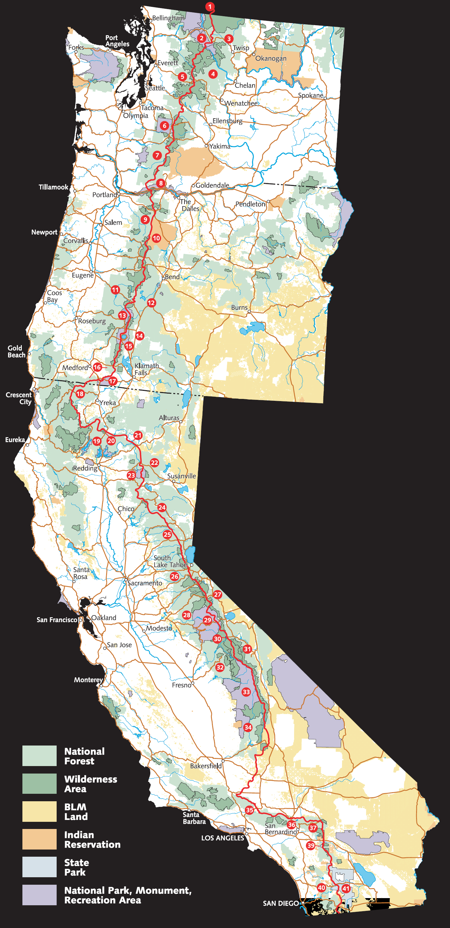
Tuesday, April 27, 2010
Departure Date Set - May 7th
For those who have been asking - Moose Charmer née Nicole and I will be departing for the trail May 7th. Steiner and Emily will be joining us in early June, and we -hope- Hee-Haw will be meeting us for the last month or so.
Tentative mail drop locations to follow... Moosie and I just bought 70 days worth of food and it was pretty intense. I'm in the process of sorting them all into 2 and 3 day ziplocks for easy shipping.
Tentative mail drop locations to follow... Moosie and I just bought 70 days worth of food and it was pretty intense. I'm in the process of sorting them all into 2 and 3 day ziplocks for easy shipping.
Friday, April 23, 2010
Sobohobos on the move again!
Welcome to the Sobohobos PCT 2010 blog! We are a group of hikers who met on the Appalachian Trail in 2005 and have decided to thru-hike the PCT this year. Please stay tuned for posts as we update our progress with thoughts and pictures. You will be able to follow our progress via our Spot Messenger on Google Maps via the links on the right as well as see any mail drops we might have upcoming that you can send goodies too!
Please leave your comments and thoughts as nothing is better than coming off the trail for a day and checking our blog and seeing that our loved ones back home are following us!
You can see our journals from the Appalachian Trail thru-hike http://www.sobohobos.com
-Barrel Roll, AKA Shian
Please leave your comments and thoughts as nothing is better than coming off the trail for a day and checking our blog and seeing that our loved ones back home are following us!
You can see our journals from the Appalachian Trail thru-hike http://www.sobohobos.com
-Barrel Roll, AKA Shian

Subscribe to:
Comments (Atom)