Sunday, June 30, 2013

Day 14

After surviving the night (we ate some wild chives), we broke camp and climbed an additional 1000' or so up Switchback Pass. This entire ridge walk is unspeakably lovely. I hate to say it, but it looks like a Windows screensaver: blue sky, yellow wild flowers fluffy white clouds. We came across a glacial lake which was comparable to the most beautiful glacial lakes in the Sierras.

The climb of Switchback Pass necessitated the use of microspikes, and I was glad to have them. I think we maybe started the trail 3 days too early, but hard to argue with such lovely weather.

We took a long switchbacking trail back to the valley floor, and made our way to an established campsite. The site is strangely free of mosquitoes but infested with moths. They seem drawn to salt, and easily the most popular item in camp is Gangles' socks.

Tomorrow, we get to see the Chinese Wall, which will be a long climb. Off to bed.

Mileage: 15mi from somewhere on the pass to somewhere on the creek floor

Friday, June 28, 2013

Day 12

[As I write these entries, I wonder if anyone is reading them, I have been hearing from other people that my entry on Triple Divide Pass has resulted in some stern imprecations from parents, so maybe someone is reading these entries? If you are, please do write back! Send us some mail--see upcoming stops on our 'send us mail' page]

Another beautiful day on the CDT. We are now on Day 3 away from E. Glacier, and firmly on our way in the Bob. Soon, we'll be far enough that the shortest way out will be to go South rather than backtrack, which is exciting. The weather has been hot and dry; nearly all the snow has melted off by now, and the rivers are running glacially cold. Every ford has been numbing with chill, and I've been going barefoot to preserve my mostly dry socks and shoes.

I've switched to a double sock system, toe socks under thin non-cotton socks (currently: pastel pink and lemon yellow socks emblazoned with moose prints and moose silhouettes). This has added some life to my rapidly eroding toe socks, but has doubled my de-socking / socking time at each ford.

Also, I finally stopped fording barefoot--it is much better in my camp shoes (Vibram five fingers). No more barefoot fords in this ultra cold water. Lovely day, rolling up a ridge on nicely sculpted switchbacks, running the ridge, and then rolling down a few times.

When we stopped for lunch 8.5mi i, we were all starving. Whenever I sipped water, I could feel it hit bottom, in that completely empty stomach feeling, like throwing a bucket of water into an empty metal wash bin. CLANG.

As part of my training for this trip, I had been doing some fasting running, i.e., fasting 12 hours and the busting out a relatively brisk 4-6mi on a completely empty stomach. While I felt somewhat trained for this moment, never comfortable to be cruising on bile alone.

We had lunch at the top of the ridge, and dried our wet tents. We were joined by a pair of sobos, Little Bug and Aaron (no trail name yet). They were very cool, park service people from the Southwest. We learned from them, and from a quick moving sobo, Steve (CDT '07), that Lush, Man Party, Columbus, The Captain were a few miles back. Hope we run into them soon.

The rest of the afternoon was extraordinarily hot. We decided to attempt a bushwack around Badge Larke for fun. This was largely pointless, since it would have saved maybe a half mile, but we were up for an adventure. Somehow the Ley maps were slightly off, and we ended up on a long, steep bushwack through a densely wooded hillside. Pride and structural integrity of the our clothing mostly intact, we rejoined the CDT with great relief. To quote the sage Trailbait, "don't do it! It's not worth it!"

Gangles and I rolled up to Badger Pass. The trail was oddly undulating, with deep grooves in a long sine curve. Must be some side effect of the tremendous snow melt which must come through. We traipsed down the cracking, sinuous sun-baked trail, Gangles long legs reaching gracefully to the highest amplitude of each curve.

Being cursed with an Asian's inseam, I had to bound from local max to local max, and so spent another fairy like day leaping across the trail.

A few miles past Badger Pass, we stopped in this lovely meadow to camp. Though we are enjoying the flowers now, we will all be soaked with condensation in the morning. Carpe Diem.

Also, think we made an important discovery--an alternate (the purple, not the red on the J. Ley maps) to Benchmark which may shave some miles. This means our rations have been upgraded from bare bones to meager, and possibly to filling. (<--this is an Oregon Trail reference, for anyone else who went to elementary school in the U.S. and did a pioneers unit in history class)

Mileage: 15mi from 1 mi past the bear sighting to ~1.5mi past Badger Pass

Day 11 - leaving Marias Pass

[Let me begin this post by saying that we are 100% fine, doing this by choice, and having fun. I've heard 2ndhand that some of these posts have been alarming, but wanted to emphasize we are in great spirits]

Last night, the kindly and wise campground host, Randy, at Marias Pass gave us the latest trail news from Marias pass headed South. A few sobos (Train, Smiley) left two days ahead of us. The official CDT is relatively clear, so we took the PUD way, which was nicely maintained. The trail is in an in between phase now, relatively dry in parts, but then muddy sinkholes in adjacent patches. I spen the morning leaping and mincing like an overgrown fairy, delusions of Tinkerbell's grace, but a more functional and less beautiful set of leaps and lunges.

I completely misjudged one creek crossing, and lost my left leg down to the knee, sunk in oozing, stinking mud. bracing my hands against the nearby rocks, I pushed up with great effort and managed to extricate my leg with a whooshing, sucking noise. Below the joint, my left leg was golem-like, grey, humanoid and incredibly heavy.

I walked it off for the next mile or so until we stopped to snack, then rinsed my pant leg and gaiter thoroughly in a stream. I missed my invincible avenging leg, but thought reducing the weight on my left leg by a few pounds was worth the long term trade off.

At the 13.5mi marker, we stopped and cooked dinner, then decided to push on another 1-2mi. Bigfoot, Swiss Miss, Very Fit (aka the Swissfits), Gangles and I were marching along, about to cross a river. We were discussing our favorite book from the Little House on the Prairie series when the line abruptly stopped. After narrowly avoiding an ice axe tip in the nostril, I jumped back and I heard someone mutter some choice words.

Ambling across the river, like the biggest, baddest thing in town, was an enormous black bear. Don't tell my mom, but I've come across bears on the AT and PCT, and this was by far the largest I've ever seen. (Swiss Miss, another AT, PCT hiker agrees). The bear was chewing on something, and sauntered up the trail on the other side, oblivious to us. He (I'll just assume 'he' since he was so large), had not heard us approach even though we were in full conversation. So, a reminder to make noise at waterfalls, rivers and any other noisy site.

The bear was now standing opposite us, on the trail we needed to continue on. We stood in morbid fascination.

I did the same thing I did the last timeI came across a bear which did not immediately run off, I clacked my hiking poles together. The bear turned his head to look directly at me, and his ears twitched. He stared at the five of us on the other bank, just 40 feet away.

I'd always heard black bears were shy, and this one took off like a shot, and turned uphill and disappeared into the brush. We waited a few minutes (bear cooling off period), then went South, following in the bear's direction with frequent bear alerting noises (e.g., Hey Bear Hey!).

We were all a bit shaken, and ready to camp. There was no way we could outrun a bear, so no matter where we stopped, we would be in its territory. We went up the trail maybe a mile, but the camping options were not suitable--everything was too steep, too wooded or pocked with prairie dog holes. I had terrible visions of an intrepid prairie dog chewing through the bottom of our tent.

We finally made the suboptimal, but best fit solution to tent in the middle of the trail, which by this point was an old jeep road. We could fit 1 tent across the width of the trail, and stacked all 7 down a hundred feet of the trail. We created a passable avenue down the side, with the expectation that we would be out and packed by 7am.

We were all so spooked by the bear that we hung everything smellable (food, DEET, hand sanitizer, toothpaste) as soon as we got into camp. The spindly older pines made this an epic process, but we finally got everything up, and had an uneasy sleep.

Mileage: 15mi from Marias Pass to ~1.5mi past the Badger Creek Ranger station

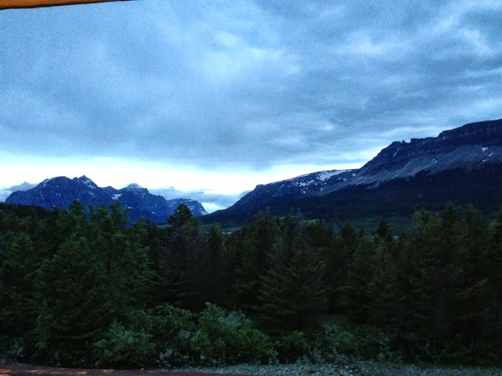
Photo: tail end of alpenglow on the clouds at Marias Pass

Wednesday, June 26, 2013

Day 10 - first day of the hike?

Today, we leave the beautiful and sculpted confines of Glacier National Park. This means leaving civilization, and entering the "Bob". In a few ways, it feels like we are finally starting the CDT: the wildness, multiple alternate trails, unknown quality and condition of the trails.

We started this morning from E Glacier, where we met Beth, trail angel from our first day. Since we are entering the backcountry for ~10 days, our food bags are as heavy as they've been, and hopefully as heavy as they will get. She drove our food bags up to Marias Pass, tonight's destination, in a partial slack pack. With much lightened packs (Gangles and I split 1 pack for the day), we took off for the pass.

The trail conditions were quite good, though a bit wet from the runoff. THe snow was minimal, and we didn't need either ice axe or microspikes. The day was highly reminiscent of the AT, rolling around ridges, slight ups and downs, but no major climbs. The trail was still relatively passable, early enough in the season before they are overgrown with brush. I hear this is one of the advantages of going sobo.

I loved the verdant lushness of the trail today, so lively and green everywhere. Though it is late June here, it feels more like late Spring, with the hills coming alive from a long slumber under snow and rich soil. It is what I imagined the "woods" were like when I was a young, bespectacled child, reading stories of hunters, explorers and early colonists. Truly lovely.

Tomorrow, we are aiming for ~18mi in. It will be a long day, with potentially tough fords. I'm convinced it is all doable, quite safe, and just part of the adventure.

I am already looking forward to the hikers we will be by the time we exit the Bob. We will be on our way to getting our hiking legs, coupled with dropping the snow equipment (axe and spikes), we should be feel strong by the time we reach Lincoln.

Fantastic first day in the Bob.

Day 2: Many Glacier

Day 1: Lake Elizabeth

12 days of radio silence

Entering the "Bob" this am, may not have cell reception for 12 days. Don't worry; we will run SPOT, so you'll know our location.

Thanks for all the good wishes!


Sent from iPhone

Tuesday, June 25, 2013

Day 9 - first zero

A full town day with no hiking. I'll keep it brief, since nothing much exciting happens on town days. The first and most important order of business is food--both town food and resupply.

Apparently, I have the attention span of a 5 year old, and a penchant for wandering grocery stores for hours looking at new products, positionings, packages, etc. I'm a glacially slow and highly distracted shopper, which I consider to be a professional hazard of working in consumer goods. That said, I'm an inefficient resupply person, so Gangles leads the charge here.

The other bit of business, gorging ourselves, invoved to exceptional meals: breakfast at the Two Med Grill (fabulous), and a delicious New Mexican place, Serrano's. Chatting with Bigfoot, we estimated our daily caloric expenditure while hiking at ~4,000-4,500. I'd guess we consume ~2,000 calories per day on the trail, so we try and close the gap in town. This is equal measures delicious, time-consumer and disgusting. I order food opposite to the way I would in non-trail life: extra sauces, heavy on the starches and fried foods, and highly calorically dense. Most hikers spend the day eating non-stop, and mostly junk: potato chips, ice cream. I personally don't have the patience to graze all day, and try to keep it down to 2-3 massive meals. I have to stop eating when I begin to stretch the physical limits of my stomach capacity, and it hurts to go on.

Though this sounds as though I would be gaining weight rapidly, my pattern on previous hikes has been to lose some weight (~5lbs) early on, then regain it over the course of the trip in some additional muscle mass. The major confounding factor is the temperature--if it is cold, the pounds just drop as our bodies use up any available stores to keep us warm.

All in all, a lovely day. And a lovely night at the Glacier Park Lodge. Enjoyed an acoustic concert in the lobby. Realized I'm a little starved to hear music, and enjoyed listening to something I don't hear on the trail.

Oh, and the photo today is from the balcony at the lodge. There's a ladder with a light at the top. Obviously, Gangles and I had to explore. The ladder reaches directly to the roof, not a roof deck, but to shingles and a rain gutter. It really should be capped. But so fun to climb up mystery things!

Ok, off to bed. Tomorrow starts our longest, wildest stretch of the trail in the Bob Marshall wilderness, more commonly referred to as "The Bob". We'll be carrying 7.5 days of foods, so our packs will be very heavy. We'll pick up food at a rustic ranch, but won't be in town until we get to Lincoln in 10-11 days. Will definitely be looking forward to town comforts like showers and restaurant foods.

Night.

Day 8 - back to the start in E Glacier

Ah, the first big town day, and the first milestone, exiting Glacier National Park (mostly), and starting on the next leg of our trip.

After a mostly dry morning, with intermittent showers, we saddled up at the Two Med campground and rolled out to the ranger station. We ran into Ranger Ankerbauer who had helped us get our permits on the first day. HE told us that the trail would be mostly clear of snow except with limited patches, and that we would be hiking in the rain after noon.

As we were chatting with him, th rain started to roll in, and we put on our backpacker ponchos. He piped in some music over the speakers for us--Eminem's "Lose Yourself" to get us sufficiently pumped up. We then ran out of there and started our 5 miles, 2500' climb to the "scenic point". Almost entirely clear of snow, we bulled our way up a seemingly interminable set of switchbacks, climbing higher and higher above the Two Med Lake and the campground.

Near the apex of the climb, we saw a small moving figure at the near crest. As we approached that figure turned out to be one of a flock of ~25 bighorn sheep. There were several mature males in the bunch with magnificent, fully developed horns. As we walked by, it was eerie to see all of their eyes follow our progress across the hillside.

Knowing that it is bad to surprise wild animals, Gangles and I decided to sing so the sheep would know exactly where we were. We focused mostly on the capitalist paean, "Part of your world" (from "The Little Mermaid), after abortive attempts to remember the lyrics to "Proud Mary".

I was wondering if my off-key caterwauling was antagonizing the sheep when the one nearest stood up as we passed, and I worried for a minute that my ignominious end would be falling off the hillside after a ram's head butt. The ram head swiveled slowly, watching us carefully, then he shifted his haunches and peed. Gangles thought he was marking his territory, and I just hoped that he really had to go.

AFter switchbacking steeply, we ran into Very Fit, Swiss Miss and Barrel Roll, and we five decided to roll into E. Glacier together. The trail merged with a jeep road, pocked with hoof prints and tire ruts. It was mostly dry, but quite muddy with long patches of boot sucking mud. Trails diverged off of it, to the left and right, but we resisted temptation and stuck to the jeep road.

Now, one thing I had heard on the CDT is that most people have at least a daily moment when they are "misplaced". I had never understood the distinction between "misplaced" and 'lost" until today. As far as I understand it, "lost" is a complete wtf moment, stuck in the brush on no trail at all. "Misplaced" means you're on something but you're not sure if it is the CDT.

We eventually came to town just before the rain came.

First order of business, I showered. For the first time in days, and it was glorious. Then laundry, then food. Laundry is always a fun moment, when you improvise something to wear while your only set of clothes (it's like being a cartoon character!) is being washed. Barrel Roll out-coutured us all with his backpacker poncho skirt.

Clean clothes, clean skin, full bellies, satisfying return to East Glacier.

Greetings from East Glacier

Ah, the trail.  I cannot believe it has been only a week.  Already it has been crazy, inspiring, brutal, and beautiful.  I feel so close to our trail family but, at the same time, so small and insignificant amongst these mountains.  If (min,max) of normal like was (-1,1), on the trail it is (-5,10). 

During our road walk in the rain, I thought I would send a blog post that simply states "sucks balls."  We faced terrifyingly close lightning storms and hail that would have put that cheap apricot scrub exfoliant out of business.  However, a day of recovery , some gentle defrosting, and warm homemade pie, and the sunny days that followed have since brightened my mood. That was the -5 part, now onto the +10. 

Majestic doesn't even begin to describe glacier national park.   It continues to reveal mile after mile of lush green medows, ice blue lakes (think Sierras PCT readers), sheep, goats, and wildflowers.    I lose my breathe each time we step into another bowl and see our next set of mountains to conquer (or skirt around =) ).  One of my new favorite games is to choose the interior colors for a hypothetical future house Steiner and I will build.  Currently, I am into this pale sea-foam green rock that led the way up triple divide pass paired with a bright sandy tan that has been speckled throughout the hike.  Steiner is carrying samples of both along with a deep red (from Red Gap) I liked for future reference.   I know, we are clearly not light-weight hikers.   

The day we crossed triple divide pass was by far my favorite day on the trail and perhaps my favorite hiking day ever.  We carefully planned our a small river crossing, forded as a team and bushwhacked a few miles around to avoid crossing the stronger river.   We ran along a moose run and I felt like we were in the woodsy animal know.    It was every child's dream of being a explorer and charting unknown territory (except for the fact that if we needed to, we had a GPS that could tell us exactly where we were).   Later, we encounter what felt like Odyssey style challenges with snow fields, waterfalls, and stubborn goats.  Working as a team through these obstacles in one the most beautiful playgrounds in the world was complete bliss.  Thanks B/rainbow team for the great day, the encouragement, support, and laughs.

All in all, as  Steiner says, I'm "happy as a clam" to be here.  Tomorrow we leave Glacier Park and head for the Bob Marshall Wilderness.   Time to catch some zzz's before the next 10 day stretch.  

Text or email me and I'll write back when I am in town next. Love to my family and friends.  xoxo

Sent from my iPhone

Sunday, June 23, 2013

Day 7 - Another day, another not recommended pass

Today, we went over Pitamikan Pass, which was described as the most dangerous of the four passes on the trip. It is also our last pass before we go to East Glacier to nearo (hike small miles, usu <10mi) into a town and resupply, eat hot food, do laundry, call loved ones, etc. So we were quite determined come hell or high water. The approach to the pass was thick with snow, and we had microspikes on for ~2 miles during the climb up.

I was hiking behind Barrel Roll on a snowy patch when he unexpectedly rolled an ankle. He literally fell backwards and lay in the snow writhing in agony. He has an unfortunate tradition of rolling his ankle on thruhikes, so was somewhat expecting this, and saddened all the same. He took a few ibuprofen, and he gamely walked on. Unfortunately, I think this may plague him during the rest of the trip, but he always toughs it out.

He had a trekking pole strapped on his pack which nearly sliced my leg as he fell, but I managed to mostly jump back and was merely grazed. I was quite lucky. He did wipe out on one of my poles which is bent at quite an awkward angle. I'm hoping the kind folks at Leki can send me a replacement part.

The rest of the ascent was stunning, snaking between two glacial lakes which are still deep blue and studded with floating, rectangular icebergs. The top of the pass was beautiful with views of the two lakes, Mt. Morgan and the lake in the distant South. We rolled South, which was relatively clear, with the occasional sketchy snowfield. Nothing impassable, esp. compared with yesterday. But, if there's one thing the trail teaches out, it is hubris. We reached a snowfield so slick and soft from the afternoon melt, We did not think we could cross, even in microspikes.

Swiss Miss found a direct path down the hill, which involved a steep scramble down a rocky and grassy cliffside. I slide down on my rear for parts, and had my ice axes and pole ready for the rest. The descent was possibly the most stressful of the hike to date. Emotionally spent, we lunched at the base of the cliff, sunned our soaking tents, and then walked into Two Medicine.

The campground is the very lap of luxury, replete with bear boxes, flush toilets and established campsites. There are even picnic tables! I washed down by the river, like a river nymph, I like to think. However passersby probably mistook me for a homeless person, crouched in her underwear, standing on a rock by s bridge, sponging herself with a buff (a circular non-cotton bandanna). The water was glacially cold (no pun intended), and I couldn't swim for fear of my muscles locking and needing to be fished out.

Also ran into the ranger we had met 7 days ago looking for a permit. So nice to see him, and gave him the scoop on trail conditions and wildlife sightings.

Once we all convened, we rolled on to the local camp store (i.e., a small general store to serve campers). The feverish trail rumor was that the store had hot dogs! When we arrived, the hot dog machine had just been shut down, rollers no longer spinning. Even so, Emily and I managed to consume nearly 1,000 calories apiece from some combination of microwavable burritos, Sprite, boxed triangle chicken salad sandwiches (from "mechanically separated chicken parts"), and popcorn. I nearly blacked out at camp, so eating such a large meal was rejuvenating.

Also, forgot to mention, on the way to the campstore, ran into a gentleman with a pair of binoculars scanning the crest was had just descended on the way into Two Medicine. He let us use his binoculars, and he pointed out the first grizzlies of the trail, gamboling on a patch of grass high on the mountain. That is and was the ideal distance for grizzly encounters. Knock on wood.

Weather tomorrow has a 90% chance of precipitation starting at noon. Plan is to run the 10.5mi to East Glacier and hole up before the rain hits.

So, bed time.

Mileage: 15mi, Atlantic Creek to Two Medicine


Ginny Too
Sent from iPhone

Day 6 - most fun day on the CDT yet

"NOT RECOMMENDED"

Our permits through Glacier National Park read "NOT RECOMMENDED" in big blue letters. Our journey from the Northern terminus of the CDT, Chief Mountain at the Canadian border winds through a few mountain passes and valleys which are still steeped in snow. Of the four passes on the CDT, only one has been deemed "safe" by the rangers, i.e., passable. That doesn't mean that the pass is impassable (no pun intended), but merely that it hasn't been officially opened.

We bailed on Piegan Pass since we were due to hit it during a thunderstorm. Ultimately, it was the right decision since that very day we would have crossed the pass, we were caught in a thunderstorm and intermittent hail. Truly terrible. A few other CDTers (Lush, Manparty, The Captain and Columbus) attempted the pass that day and turned back due to the thunderhail

Anyhow, this is a long, convoluted story to say, we tried another pass today. We had heard from Ranger Ed in Many Glacier that Triple Divide Pass was likely safe. It's typically the second pass to open, after Red Gap. The approach was clear, but just as we got above treeline, we were in a long snowfield. The trail was completely obscured. We pulled out microspikes (i.e., baby crampons) and ice axes and started steeply up. Some previous hikers had carved snow steps, and trail explorer MVP, Trailbait started up the the steps. At the top, she started yelling something, but I couldn't hear her.

By then, I was nearly 2/3 of the way up, and continued to climb. Once I reached the top, I realized what Trailbait was trying to tell me: We were standing on the edge of a cliff. I had climbed up one hundred feed up a 70 degree snowfield and was now peering into a deep blue-ish abyss. Carefully looking away from my imminent death, I tiptoed along the cliff until I came out to the larger snowfield. Hearing water running beneath me, I became suddenly concerned that the snow beneath me was about to buckle, so I continued to move left until I was certain the snow beneath was silent. The remaining thousand feet of climbing or so was relatively uneventful, going through a mixture of friable red and green rocks, and long snowfield necessitating spikes. The pass itself was lovely, extraordinary 360 views of the nearby peaks.

We descended South on relatively clean path, and even saw 2 flocks of Bighorn sheep up close. They were quite mangy, as they were switching to summer coats. The matriarch of each flock lingered watchfully as we neared as the rest of the sheep fled to safely. Enviously, I watched them tiptoe gracefully across the snowfields.

I don't even know how to begin the next section of the hike. As we descended we came across a 15-20 snowfields, each was quite dangerous. I hope my parents are not reading this. Because I will say that my children are *forbidden* from hiking the CDT. The traversing of these snowfields was most definitely NOT RECOMMENDED. On a few, I flashed back to Ranger Goodwin who we saw on the approach to Triple Divide. We told him where we were going, and he papally crossed us, and said "Go with God". He meant it.

Some of the fields were simple traverses requiring careful tiptoeing across the fields, lest you tumble to a steep and rocky fall a few hundred feet down. Others were...

Well, a few you passed close to the side of the mountain, pressed between the rock and the snow itself. Some were cleared out through steep ravines containing waterfalls, so climbing across the snow, then dashing across a running waterfall to the other side. Some had water running underneath, which meant possible postholing through the snow, into the water and sliding all the way to the valley floor. The worst were the ones where we couldn't figure out how to cross safely, e.g., the snow was too thin, too steeply angled, and we had to navigate steeply above or below the snowfield, scrambling up and down the mountain. Being terrified of heights, I was in a state of high alert for nearly all of the afternoon descent.

We emerged nearly unscathed. On one snowfield, I had come across, and jumped down ~6 feet to a gravelly slide. The jump was longish, so we were passing down packs. As I took Moosie's pack, the weight toppled me, and I crashed down and burst my right knee. I actually had forgotten about it, thanks to the power of adrenaline borne of mortal peril but when changing for bed, I discovered my bloody knee.

In short, an extraordinarily fun (and dangerous) day on the trail. And a scraped knee to show.

Mileage: 10mi, Red Eagle Foot campground to Atlantic Creek campgound


p.s., 6/22, the day after the solstice, and Barrel Roll's birthday. We packed out marshmallows and Keebler Fudge Stripes for s'mores. Love trail birthdays. Happy birthday, big papi.

Friday, June 21, 2013

Day 5

As we left camp, howling wind like I've never heard, desolate as could be, a pack of banshees chased us out of St. Mary this morning.

We made a break for the woods, and the sun casting a shadow was a welcome respite. We walked through sparse vegetation, in a burn area. The damage was quite extensive, burned trunks in a twisted black and silver rictus lined the trail. The wetness of the past few days lingered, with that deep sticky mud that sucks boots off heels. As we strolled, we did startle a young female elk, and I saw her shaggy brown haunches take off up the hill. Looked like good eating, so a sign my hiker appetite is kicking in.

The way was paved with tall grasses, necessitating a tick check when we got to camp, as I bathed int he glacial lake. The water was so chill that after mere moments, my feet tingled and burned and I feared I would topple with cold wicking up my legs, and someone would find me blue lipped in my hiking underwear in the artfully scattered piles of duck guano. I stood at the edge of the lake and wiped myself down with the water and my buff, a decent day on the trail shower.

Later, Moosie and I went to get water, and were alarmed by the sound of a large-ish creature fighting through the bush. It was Trailbait, declaring "don't do it; it's not worth it". who had gone off trail towards the sound of trickling water. We pushed on another tenth or so back towards one of the many active trickles and found an vigorous one, with clean snow melt. We got back to camp, and realized the comedy of the day--it was only 4pm.

We did a lighter day today, getting our feet back. We are on a strict permit system and must be at this campsite exactly, and cannot push on or fall short. With 6+ hours of daylight left, here we were, camp chores (bathing, water, tent) done, and nothing to do.

We had a stretching party and muscle identification party, using Bigfoot's wikipedia app to learn the location and name of the piriformis (under glutes, between femur and hip). Gangles made the breakthrough to use our ice axes to massage our IT bands like a foam roller. At the height we were all lolling around the food preparation area, kneading our sore legs with ultralight ice axes.

Like the elderly, we decided to have dinner early (our blue plate special). On the plus side, the mac n' cheese with dehydrated spinach turned out great, On the downside, our over dehydrated Morningstar Farms breakfast sausage patties were tough as a mainland knockoff of an Italian hand bag. I took one of the team and ate the sausages, to save the trouble of packing them out, and my jaws still ache.

After hanging our food, we retreated from the gathering mosquitoes to the tent city ("Little Tent Tokyo") we established in site #1. We were allotted 1 site per our permit for the 5 of us, and managed to squeeze 4 tents in a 10'x20' space. THere's scant walking room, only for those with perfectly functioning inner ears, but a warm camaraderie of overlapping guylines and shared pitches. The closest thing to a dorm room we have.

Next day is a big one, over Triple Divide Pass, so far impassable except by a few other CDTers. None of the rangers have been over yet. Also a series of possibly treacherous fords of rivers swollen by the recent bout of rain. Some concerns for the safety of petite Trailbait (5'2"), but we'll all get through alright. Rejoining the rest of the party at Atlantic Creek,

Til then...

Mileage: 10mi from St. Mary to Red Eagle Head

p.s., The ranger we met today said we should keep an eye on our hiking poles. Some "mineral-crazed snowshoe hares" have been making off with the salty sticks.

Thursday, June 20, 2013

Day 4 - zero

Our first trail zero. After yesterday's horrific walk in to St. Mary, we all agreed to a much needed zero. (In trail parlance, zero = 0 trail miles). We slept in at the lodge, drying out our clothes, tents and boots, and made our way over to the St. Mary campground per our permits. Much love to Ranger Joseph and Meg for finding us nice sites.

Am currently safely and warmly ensconced in front of a roaring fire, typing up this blog entry. Just overheard a waiter describe our entrance yesterday, "a bunch of hikers looking real rough". We are all healing up, and looking forward to hitting the trail tomorrow.

Trail gossip is that the trails are still tough, a lot of snow (ice axe definitely needed), and high fords (chest high). The rains over the past few days will make this an interesting next few days. Just bumped into 4 hikers who bailed on Piegan Pass due to lightning and hail up top. We'll have to be measured in our approach, since I have no interest in channeling lightning through my ice axe.

Met more of the CDT pack today: Smiles, Columbus, Huck, Bluefoot, Train, and so many more. Looking forward to seeing more CDT hikers along the way.

Will now focus my mental energy on channeling protein to my healing feet and legs. Eager to get back out tomorrow.

Day 1

After a helpful hitch from Beth and Emma from East Glacier, we started off on the CDT at the U.S.-Canada border from Chief Mountain. Wonderful weather.

I was astonished that Montana was as grand as I imagined it could be--as an East Coast gal, Montana has always been wide plains, huge mountains and it is all true and more. The CDT has the intimacy of the AT, the single track trails snaking through pines but the difference is when you burst into a clearing, you're in a tremendous bowl of wildflowers and enormous sheer crags.

Trading the desk for the pack means new aches and pains. Bruises on hips, clavicles, gripped by my too heavy spider monkey pack. Outfitted with 5lbs of spare clothing, fingers crossed the weather stays clement.

Had a comical experience hoisting our food up in camp, thanks to Grinder's strong arm and general manliness.

Familiar to be back on the road, unfamiliar to be out west in the mountains, this will be an experience of a lifetime for sure. Glad to be back in the warm embrace of trail family, the sobohobos ride again.

Mileage: 12mi to Lake Elizabeth (head)

Wednesday, June 19, 2013

Day 3

After much discussion about the weather (100% chance of precipitation, thunderstorms, damaging winds), we made the group decision to roadwalk around Piegan Pass. The idea of the nine of us up top, waving ice axes during a lightning storm was too risky.

Instead we hiked 21 mi to St. Mary,

First half of day was fine, but second half had terrible weather. Thunderstorms, driving rain, sleet and even hail. Which really hurts the face. With the terrible weather, we nearly ran to town, and ended up at the very hospitable Park Cafe. Terrific pie--strawberry rhubarb. Thank you to Romain for the recommendation.

Drying out in the St Mary Lodge. Ashamed to be in a hotel 2 nights in a row, but looking to ride out the terrible weather. Cautiously optimistic that the weather will turn.

p.s., everyone's hiker hobble in full force. feet bruised and puffy--inflammation is my own air cushion. My shoes are so springy.

Mileage: 21mi from Many Glacier to St. Mary

Day 2

Best of intentions for an early morning, but the usual fussing around in camp. Didn't get going until 930. Traced the north shore of Elizabeth Lake (seen below) and then rejoined the CDT. We climbed up Red Trail Pass, our first big pass. Was a long, meandering climb, switchbacked above treeline, and had lunch up on top of the pass. V. aggressive chipmunks tried to drag the trekking poles away. Apparently the chipmunks love the salt in the handles. The equivalent of finding a slim jim the size of a downed tree in the woods.

Met a WG '15 going up the pass. Dan. Small world, running into a WG '10 and WG '13.

As we came down the pass, there was a snowfield, maybe 100' x 500', and we glissaded down. Certainly didn't save any time, but loved the novelty of the slide. And practice with the ice axe to self arrest.

On the way down, a storm came in. We were socked in fog, descending to Many Glacier, surrounded by nearby lightning. We hustled down, in ponchos through the driving rain. Weakened and sprung for a hotel room instead of camping in a puddle. Split a room with Swiss and Very Fit, and ran the space heater to dry our shoes. Warm welcome by the staff; hospitality from Swiftcurrent Motor Inn was a welcome respite from the rain. Tomorrow is a new day.

Hiker hunger has not kicked in, in terms of volume, but definitely in terms of quality. Intense cravings for just terrible things I would never eat in real life. Put a serious dent in a package of birthday cake oreos.

Mileage: 21mi, from Elizabeth Lake Head to Many Glacier

Sunday, June 16, 2013

In East Glacier. Sorted permits. Hitting the trail tomorrow. Bellhop outfits to celebrate first golf course in MT

Saturday, June 15, 2013

On our way!
Connecting in Denver. Next stop, Kalispell, MT!

Tuesday, June 11, 2013

We're gettin' the band back together!

In four days, the sobohobos will reunite in Glacier Park, MT.  We will head southbound (sobo) on the CDT, headed for the border (armed with appropriate and legal documentation!).

So much to do, so will keep this short, but looking forward to keeping in touch with everyone here.