Friday, August 30, 2013

Day 74 - Treasure of the Sierra Madre

Today was relatively uneventful. A tough day, and probably a taste of what CO will look like: long mellow sections interspersed with steep climbs at high elevations. The balds in the Sierra Madre are breathtaking, with jagged grey and blue peaks in all directions.

We did run into several elk hunters scouting on ATVs, which means no wildlife sightings. The season starts on Saturday, so we'll have to keep our wits about us. ATVs are incredibly loud. Funny, that the hunters were complaining about the free range sheep which scare away the elk. Someone's always scaring someone.

And on the start of our last climb of the day, we ran into a woman at the Seedhouse campground--she was exiting a day early because her dog was feeling the altitude. She insisted we take some food, a few ProBars, tuna, homemade dried peaches. Thanks for the great trail magic.

Hope the weather stays clear. Wishing everyone a great start to Labor Day weekend!

Mileage: 24mi from WY / CO border to near Three Island Lake

Wednesday, August 28, 2013

Day 73 - Colorado and the ballad of Shorty Ballard

This morning, while milling around at the post office, we had the pleasure of meeting Mr. Shorty Ballard. I mistook him for the mayor of Riverside-Encampment, since everyone who at the post office stopped to say 'hello' and share a bit of the latest town happenings. Mr. Ballard kindly gave us a lift from Encampment up to Battle Pass. He was a fascinating character, so I have to share a small slice of what we learned.

Mr. Ballard asked if he looked 94. I thought he could pass for a spry 71, but he's actually 82. And he's a native Montanan, born in Augusta. He was orphaned at 9, and spent a few years running around before someone collared him and made him a ranch hand when he was 12. He earned $1 / day with room & board. He later became a rancher in the Encampment area, and told us all about the town's history as a mining boom town, then a lumber town, then oil, and now in its dotage, fittingly, a retirement town. One of the nearby homesteads (including logs) was bought by his friend for $310, with $10 down. His friend said he was good for the balance, but was fretting about how he was going to eat that month. While exploring the property, he found a strap protruding from the ground--it was a purse with $2.80 inside, and his friend made it through the month. Mr. Ballard was full of fascinating anecdotes about the town, and our ride was sadly too short. Mr. Ballard, thank you very much for the company and the ride. I wish you the very best.

When we got back on trail, it was a little after 11am. We were 20mi from the state border. It would be a frenetic day, but I was determined to make it to Colorado for my own mental health. Wyoming hath 23 days, if we made it today.

We booked it, and just as the sun was starting to set around 7:45pm, we crossed the border. Gangles let out a huge, echoing whoop! The maps note that it is not well-marked for southbounders, but someone has arranged rocks to mark the border, spelling out the states.

We are officially done with Montana (and Idaho, if you count it) and Wyoming! Hooray!

Tomorrow is our first full day in CO. And next, on to Steamboat Springs. I've been promising myself a haircut in CO for months, and it is almost time to tame the mane.

p.s., Thanks to Elana, Genna and Benji for the amazing care package. Who knew funfetti + poptarts = delicious

Mileage: 20mi from Battle Pass to the WY-CO border

Day 72 - Encampment / Riverside

Trees! Water! Trail! It is so good to be back on the CDT. I've missed you so. We are beginning the transition into CO, and away from the desert of Southern WY.

Spent the morning leapfrogging with Mike Sydlaske! (aka "Rainbow") We left camp about 30m after him, and saw him shortly after we crossed Divide Peak.

We stopped for a long break at the first clean water source from where we camped last night. It was the first good looking water I've seen in a while. It was cold and clear, so unlike the brackish water we had been seeing. As we were sitting there, who should show up but... Steve! I never think I'll see that guy again. Since Mike is taking another day to go into Encampment, we sadly had to leave him at the creek.

So, we finished the last 11mi with Steve, chatting and catching up on the trail and other news. We also went past 11,000' for the first time at Bridger Peak. Near the top of peak, we saw a metal covered wagon, but no one was home. Apparently, these are the mobile homes of the shepherds in the region.

When we got down to the road, it was a longish hitch since there was so little traffic. An amused pair of truckers named Ron and Jacob kindly took us into town. Ron was a real mensch. Thanks, guys.

They took us to the Mangy Moose, where we had a wonderful cheeseburger. It seems to be the place to eat in town. In for the night, then PO in the morning.

Hopefully CO tomorrow!

p.s., Mike, hope we cross paths again! Have a great hike!

Mileage: 19mi from past Hartt Creek to Battle Pass

Monday, August 26, 2013

Day 71 - More guts than a government mule

Water, water everywhere and not a drop to drink. We were out early today, by 6am, in search of water at the Tetons Reservoir. The sun was still low in the sky when we came across the huge beautiful blue pool of water. As we approached, I noticed a few odd things I never thought I'd see in the WY desert: clammy air, crawdad shells, and seagulls. I must have misunderstood the BLM site, because the water at the reservoir was saltwater. The recreation area had everything else: bathroom, tent sites, parking spots, picnic tables, trash cans, grills. But no non-saline water.

Since we had planned this section on getting water here, we were in deep trouble. The next decent water was another 15-20mi away depending on our route. I started to panic a little. Gangles and I decided the only thing we could do was ask a passerby for water. Fortunately, the second car which went by pulled over. Inside was a retired gent with a 'NRA forever' hat. We explained what we were doing, and he told us "you've got more guts than a government mule". Which of course made me pine for a government mule. He was carrying 2 liters of bottled water with him, and offered them up. We thanked him profusely and kept on walking. When we saw him a few hours later, he pulled over again and told us to keep our eyes peeled for elk, which are good eating. I agree with him, but all of my attempts to hunt elk barehanded have been unsuccessful.

Later in the day, a red jeep marked 'Wyoming Water Department' pulled over. The man inside spontaneously offered us water, which we gladly took. That must have been the first of maybe 7 different people who pulled over and offered us water. We must have looked thirsty walking the side of the road.

When we reached the first 'good water' as noted on the J. Ley maps, it was the North Fork of Savery Creek. It was next to a construction site. The water wasn't flowing, but was sitting in a deep brackish pool. Just as I was about to dip, the crew boss came over with a very wet yellow lab. He told us he wouldn't drink that water since his dog had been playing in it all day. He offered us bottled water, and we followed him back to his truck. He also gave us grapes, celery and offered us all sorts of food. We were happiest to see the water. He seemed like a 'good dude', as my military buddies would say. Funny guy. We discussed the local radio stations, the CDT, and Southern Colorado. He obviously though we were nuts for walking across the country. I can't disagree. He also mentioned seeing 'an Oriental guy pulling a handcart [ed. note: sounds like a rickshaw] to California two weeks ago', so he must see all kinds.

I should note, my Asianness has been unusual here in MT and WY. Living on the East Coast, I'm just one of many. Out here in the smaller towns, I tend to stick out. It comes up indirectly in conversation. People will come up to me and ask me questions such as: What really killed Teresa Deng (the C-pop Madonna)? Why does Tsingtao beer taste terrible? Do you know this Japanese guy I met in Canada twenty years ago? (These are real questions; I couldn't make these up if I tried.) Once, during a discussion about how the pines in CO are being decimated by some kind of Japanese Bark beetle, everyone turned to look at me. I set them straight, I'm not Japanese and I don't eat trees.

The rest of the day was relatively uneventful. We finally cleared the construction area, where the last crew member was halfway through a true crime book on Amanda Knox. Gangles promised not to ruin the ending.

We came across Hartt Creek, which was infested with cows. I insisted that we keep climbing to the headwaters, where it would be cleaner. When we arrived, it was dry, since it was so late in the season. So almost 50mi from Rawlins, and we have yet to drink trail water. We decided to push on, and will take an alternate which hits water in 5mi or so, around mile marker 64. This is certainly the longest I've ever been in the backcountry without drinking trail water, and I like it. I've been fretting about what a steady diet of bleach-purified water is doing to my benign GI bacteria.

On the way to the next water, Gangles got a little ahead of me, and I caught up with her at the top of the ridge. She was talking to a man who she introduced as 'Rainbow'. The sun was going to set in ~30m, so we decided to push on to get closer to our next water source. As we left, Gangles turned around and mouthed 'Rainbow?' to me. Turns out, I had completely misheard them, and his name is 'Mike', not 'Rainbow'. Waitaminute. Does he have a red hat? He's out doing a section?

It's MICHAEL SYDLASKE! For those of you who don't know, I work with his daughter, Allison. When I told her what I was doing, she mentioned her father, Michael, has been section hiking the CDT for the past several years. Mike and I had traded a few e-mails before I got out here. He mentioned the sections and dates for this year, but I didn't write them down. I mean, what are the odds that we'd be in the same place at the same time? The trail is ~3,000mi long. I've been leaving notes for him in most of the trail registers, in the hopes that he might see one. Serendipity indeed.

Gangles and I turned around and hiked back to ask if he was indeed Michael Sydlaske, and he was! We decided to camp early for the night. I think he was both disgusted and impressed by how much food we ate. Hiker hunger is less relevant if you're doing two week stretches. Fun to catch up and talk trail, and to meet the mysterious man himself. He's planning one more day out than we are, so we may only overlap for tonight and tomorrow, but so happy to meet him in person.

Encampment tomorrow?

Mileage: ~30mi? From before Teton Reservoir to a few miles past Hartt Creek. (J.Ley maps have sections without mileage, plus we were off trail in search of the saline Teton reservoir)


Sent from iPhone

Day 70 - Frontier prison

Don't ever ever commit a crime in the early 1900s in Wyoming. We took a tour of the Wyoming Frontier Prison, known to the locals as the 'Old Pen'. The tour was led by an overly gleeful 16-year old who knew way too much about old timey criminal and capital punishment. The tour began promptly at 12:30pm with a demonstration of the Julian gallows, which is a way to hang a man where no one is responsible for pulling a trap door. The prisoner's weight on the trap door sets in action a Rube Goldberg-like series of events which result in his own hanging. The tour culminated with a visit to the gas chamber, where the way too perky teen described the process in detail. TMI.

The tour, while a real slice of tourist WY, really bummed me out. So, can't recommend it fully, but it is a major attraction in Rawlins. The other major attraction is a Thai restaurant called 'Anong'. It has done so well in Rawlins that it actually has spread to the larger WY cities. Delicious. My first Thai food in months.

We hit the trail in the afternoon, leaving the city limits by crossing under the railroad tracks through a pitch black pedestrian tunnel. The road out of town was a dirt road with a distinctive red tint. Rawlins was known for mining hematite, which is an ingredient in red paint. I heard the Brooklyn Bridge was painted with Rawlins red paint.

Due to the fact that we are in late August, much of the water is dry. The water which does exist is often too saline or alkaline to drink. Anecdote #1: Northbounders who did drink the water after treating it, did have GI distress within 24h. Anecdote #2: A Rawlins man in his 50s was just diagnosed with parasites from drinking this water, when he was lost in the desert in his 20s. Needless to say, we are not going to drink any of the questionable water, which stretches for 30mi South. The BLM does list the Tetons Reservoir as a water source. It is off trail, so we'll hit it early tomorrow morning.

Many thanks again to trail angels Amanda and Wayne. If you're reading this, appreciate the above and beyond hospitality. Also, you're both so talented--the cards, notebooks and the purse made of boots. Please, please open an Etsy storefront.

Mileage: 15mi from Rawlins to somewhere near Tetons reservoir

Sunday, August 25, 2013

Day 69 - Rawlins!

Rawlins! Our first town stop in the Great Divide basin. Since we were rained on with last night's thunderstorm, we were really hankering to get to town. A hot meal, laundry, shower and a place to dry out were on our minds. Since we took an extra long lunch yesterday, we were 32mi+ away from town, farther we had planned. We set the alarm extra early (for us), and were out hiking by 6:30am.

As we ate breakfast, we were joined by a pair of mustangs, one white, one bay, also eating their breakfast near the spring. They were stoic for wild animals, staying within 100', and looking up occasionally while we packed our gear and chatted. They watched us with detachment, then went back to the business of eating the grass growing near the water. Given the dryness of the basin, I haven't seen much grass at all. Smart of the horses to come here to eat.

We took off, and the day was surprisingly cool. We powered through the monotony of the terrain and roadwalking with our radios, listening to Carbon County's own Bigfoot radio, specializing in rustic rock and cool country. Fitting to walk through WY listening to songs about Western girls, good ole boys, trucks, creeks, blue jeans, and the simple life.

We spent most of the day walking near Hwy 287 which rolls into Rawlins, but splits into a bypass with a half mile to go. We had no real plan, other than to go to Pizza Hut, and start from there.

A few days back in AC, we ran into Amanda and Wayne, newlyweds from Rawlins. They had given us their contact info and told us to call them when we got to town. Since it was Saturday, we weren't sure if we should call them because we didn't want to inconvenience them.

As we were walking into town, just nearing downtown, we paused to pull out our phones and maps to get oriented. A white jeep pulled up, and it was Amanda! Apparently, her father in law saw us walking by the cemetery. He called Amanda, and she drove out looking for us. Small towns amaze me.

We are in for the night at Amanda and Wayne's. Trail angels and trail magic of the first degree.

First laundry and shower since Pinedale, and sorely needed. Tomorrow, we'll figure out the rest of it.

Mileage: ~32mi from Bull Springs to downtown Rawlins

Saturday, August 24, 2013

Day 68 - Fishes and loaves in the desert

Ruby, Jose, Laurie, Dave, Jose, Xitlally, and Fernando, thank you! THANK YOU.

Gangles and I were in a 25mi stretch of desert just past Brenton to Bull Springs. There is one water source, the A&M reservoir, maintained by an oil company. It was gleaming blue in the desert as we approached, and it was all I could do to not just run straight at it.

Turns out, there were two trucks parked there. And not only was there enough water to form a small lake, there was fish! We met a spunky young lady (she just turned 5) named Ruby, who was very curious about what we were doing in the desert. She told us not to drink out of the lake because, as she whispered, "fish pee in there!" But we really had no choice. This was the only on trail water for the next 15mi. I tied Ruby's sneakers for her, and then she showed off her blazing speed, running around the lake. She insisted on helping us dip water from the lake. And, she introduced us to her father Jose, her sister Xitlally, and their neighbors, Dave, Laurie and Fernando.

Dave was having the best luck fishing for rainbows while using his powerbait. Fernando is usually the luckiest fisherman, but his worms were not carrying the day. And Jose had an impressive chain of fish, too.

Jose kindly invited us to lunch. Lunch would be an understatement. More like a feast. He and Xitlally had grilled homemade burgers, hot dogs and seasoned fish. Plus, he kept insisting we take a few ice cold Cokes.

Gangles and I were wandering across the Great Divide Basin in search of water. And we found a magic moment of great people, great food and something we'll remember for a long time. Laurie was wise and knowing about the desert, showing us photos of an eagle she had seen, and telling us which animals to watch for in this section. Jose, Dave and Fernando were hilarious together, with their well-honed comedy routine. Xitlally was mysterious, but cooks a mean burger. And Ruby was so bright, funny and energetic. True trail angels. And though the food was delicious, we more enjoyed the conversation--learning about where everyone was from, the nearby towns of Wamsutter and Bairoil, and just goofing and cracking jokes. Thruhiking is a 24/7 obsession, always thinking of making miles. To finish a trail, it is like a job, punching a clock and getting in the hours. When we took a few hours off to chat with Wamsutter's finest, it felt like a true weekend. So, thank you, Jose, Dave, Laurie, Fernando, Xitlally and Ruby for the terrific afternoon.

When we finally left them in peace to fish, Gangles and I pushed on. The sky was increasingly overcast, and we were eventually hit for a riotous thunderstorm for the last hour before we reached Bull Springs. One lightning strike was so close that I checked my hands for singe marks.

Bull Springs is an unusual spring--it was some kind of camera pointed at the spring. As I was bumbling around in the dusky light, I think I set the camera off. So, someone somewhere monitoring a low res photo of me bumping my head on a solar panel.

Oh, and forgot to mention, this morning. After leaving that icky enclosed spring with the animal bones, we walked a few miles to the next spring, which had... bocce! Someone, I think Wired, hiked out a bocce set and left it at the spring Gangles and I had to play a couple of rounds, ad we're pretty well-matched. We split the games evenly.

Off to bed, tomorrow's a big push into Rawlins.

Mileage: 26mi from an enclosed spring past Brenton to Bull Springs

Day 65 - Population: About 7 to 57


Today was a double town day. Four miles into the morning, we entered South Pass CIty, which was once WY's second largest town, during the height of gold fever. Now, the population is ~7. Now, there are maybe 3 year round residents, but the town has been restored to be an example of a historic hiking town.

Many of the buildings from the late 1800s have been preserved, and filled with period accurate artifacts. The saloon has beers, plates and cards, the boarding house has beds, socks and blankets. Fascinating place to walk though.

 After we picked up our packages at the small store, we headed on to Atlantic City! Dice and sand! Actually, it's another small town, with a population of ~57. There are 2 restaurants in town, though they've come to some OPEC-like cartel arrangement and are never open on the same days. We sent our mail to the Miner's Grubstake, operated by Laurel. She's a former RN who now runs a mom & pop restaurant. And she's a kind of trail mother to the hikers like us who wander through. She was a little sassy with me when I walked in, since she was swimming in boxes with our name on them.

 In addition to our resupply, it was hiker Christmas! We had a TastyKake family pack, thanks to Maron. A little bit of Philly was marvelous. And warehouse quantities of banana-flavored Laffy Taffy and Nerds ropes from Gangles' parents, Mary and Todd McNabb. These two sugar bombs formed the bulk of our resupply. We actually have planned a lunch on this next section which is solely TastyKake cupcakes. The only nutrition and class we have in our food comes courtesy of Romain and Sophie, who sent a gourmet selection of hiker goodies including fancy chocolates, licorice, fruit leather and Biscoffs. R&S, thank you for taking our food to the next level. >


Oh, and after ~800mi, I picked up a new pair of shoes. They're the same make and model as my last pair (Saucony Xodus), which is just in time. My last pair were really starting to shred, and let in too much sand. Here's the obligatory before and after shot. >

After we picked up our packages, we started to despair. We needed to mail out some stuff, plus we were waiting on Gangles' new boots. Gary wanted to head out, so we were sad to lose him, but we needed time to sort ourselves. There's no PO in AC, but a wonderful woman and fellow Delmarva native Yvonne came to the rescue. Laurel managed to track her down for us. >
> Yvonne runs the AC community center, which is a combination internet hub and small general store. She sometimes lets hikers sleep in there, and we lucked out. We were able to make phone calls and use computers to sort out logistics for the next stretch. It was my first time using a real computer since Glacier NP, which was refreshing. I was finally able to reply to some great blog comments. Apologies for the long delay! I really do love to hear from you.
>
> Anyhow, Yvonne was able to mail our package for us, give us a place to sleep indoors, and feed us some delicious town goodies (i.e., fruit and soda). So, thanks, Yvonne for being a wonderful trail angel. And best of luck with your interview--you're more than qualified. You go, girl!
>
> Gangles and I spent a fun afternoon dealing with all of our town chores, and running around town. We had some fun girl talk (politics, religion and men). Though AC is small, there seems to be a lot of drama afoot. It's like Peyton Place. Or the Harper Valley PTA. I heard that there may even be a reality tv show filming there. The intrigue runs deep. If I had been there a day or two longer, I would have opened up a private investigation shop. I think it would be fun to do stakeouts on an ATV. Juicy town. And wonderful, hospitable people. Definitely worth a stop in.
>
> And the food at Miner's Grubstake is awesome. As a Philadelphian, I had to try the Philly Cheesesteak. It was pretty darn tasty, but it wasn't authentic because it was too high quality. The beef tasted like (and was) real prime rib. And I think it was real cheese, and not wiz. A great sandwich but too gourmet for the real thing. Seriously, though, the food is delicious.
>
> p.s., Finally the moment I feared came to pass. Gangles made me watch the last 4 hours of The Bachelorette. My money was on Brooks, but Chris came out of nowhere! Plus, Juan Pablo is going to be amazing. Just watching 25 women pronounce 'Juan Pablo' will be amazing.
>
> p.p.s, There was no shower or laundry available in AC. For your well-being, please sit upwind of me. Thanks.
>
> Mileage: 9mi from near Hwy 26 to AC
>
>

Thursday, August 22, 2013

Day 67 - Dry and drier

Not much happened today, other than a continuing expanse of desert. The dry stretch between Weasel and Brenton was just that--dry, save for a few unappetizing puddles. About midday, I did see an amazing mirage of a large blue reservoir, but it was a few miles off trail and private to boot.

We did run into a kind older woman working for BLM. She offered us a few liters of water, which we gratefully accepted. We could have made it without, but this way we were much less stressed.

We accompanied most of the day by Plains megafauna. Most notably, the beige Pronghorn Antelope, who are equal measures springy and curious. I'll see one a few hundred yards away, and it will bounce effortlessly away, then pause to stare at me. Curious about what I am, then immediately alarmed and spring off into the horizon. Like giant tan bunnies.

Also, a smattering of horned toads, sunbathing on the trail. They are armored all over, and look tiny and indestructible.

We've upped the mileage to get out of the Great Divide Basin ASAP, and are even hungrier and more tired as a result. Plus, our packs are just so heavy from carrying so much water, amplifying the hunger and exhaustion.

I was excited to see a good harbinger as we approached camp, a near vertical rainbow. And at the end of the rainbow, a vertical culvert with water. The water had a thick layer of film on top, but I hope we can slough it off in the morning. Also rather macabre, we found the bones of a large animal scattered around the water. I imagine a cow must have wandered into the ostensibly cow-proof enclosure but was unable to find a way out. Depressing and odd.

I've decided to count down the days left in the basin. Starting tomorrow, we have two. Wish us luck.

Mileage: 33mi from past Weasel Spring to enclosed spring past Brenton

Day 64 - Out of the Winds

Today was our last day in the Winds, and the character of the trail changed gradually. We left the high, imposing peaks and green valleys for increasingly dry and open plains. As expected, water started to be an issue. Several creeks were dry, and one we did dip our bottles in had a minerally, coppery taste which we masked with grape Hawaiian Punch.

We also solved a few concurrent mysteries: Who was that mysterious sobo we saw at Big Sandy Lakes? Whose footprints have we been seeing just a few hours ahead of us? And who is this mysterious friend of John and Regina's? Every time we saw J&R, they mentioned they were hiking with a 'Gary', but he was never there. He was always off doing a high route or alternate. Gangles and I were convinced Gary did not exist. And then just like "Harvey", that James Stewart movie with the giant imaginary rabbit (I'm blanking on the name), we saw Gary.

He goes by 3 different trail names, in addition to 'Gary': Thought Criminal (AT), Half Fast (PCT) and Summit Bagger (CDT). He's one of the few people to have done all of the 14-ers and 13-ers in CO. And he's a literate and interesting guy. We hiked together the rest of the day, which was fun.

We were trying to do a long day, to set us up for a short day into South Pass City and Atlantic City. Long story short, we fouled up up our mail. Most people go into one of the two places, but we had packages at both. So, we hiked til dusk and had views of gorgeous pink sunset, replete with coyote howls. Early morning tomorrow to South Pass City!


Mileage: ~29mi from Little Sandy Creek to close to Hwy 26

Day 66 - Desert walking

Today, we began our long trek through the Great Divide Basin. This is a notorious section of the CDT known for tedious, repetitive scenery and extreme dryness. In other words, we have to cross a 130mi section in the desert during August. Yipes.

To make this section bearable, we made two major changes to our gear. First, we went as light as possible, since we'll be humping as much water as we can carry across dry sections as long as 32mi. Second, since it will be hot like the dickens, we dropped our stoves. Finally, we got radios for entertainment.

To lighten our loads, we bounced our winter gear to Colorado. With expected daytime temperatures in the 80s and 90s, we decided to send our stove ahead as well. In AC, we found a partly empty plastic peanut butter jar. We've decided to rehydrate our food during the day, and had a very successful dry run (no pun intended) cooking our curried couscous dinner. We love it so much, we're going to get savory and sweet jars, so we can make dinners and desserts / breakfasts. Gangles, like a true Minnesotan, is especially exciting about being able to bring pudding parfaits with us.

And radio! Sweet radio. I have been without music this entire trip, and have missed it dearly. Every time I've heard music, I've teared up a little bit. And even songs I never liked sound wonderful. So, today, I turned on my FM radios and had a wonderful day of being in touch with the world. I heard the world news, local WY news, and the minutes from the local Pinedale town council meeting. Plus a mix of pop, classic rock and country. I'm still trying to figure out the song of the summer. My friends back home tell me it is 'Blurred Lines', but I haven't heard it yet. The radio is an absolute game changer.

Some time this afternoon, we ran into two trucks full of Central WY College students on an archaeological dig. I studied anthropology (Cultural not Physical) in college, so it was fun to chat with such fascinating people. One of the women in the back of the truck mentioned something about an antelope which I didn't totally catch.

It turns out she was trying to warn me; near Upper Mormon spring was a fresh antelope carcass. The water was no good anyway, shallow fetid pools. The carcass was just another reason to stay away.

So the water today was Sweetwater River, then 15mi dry. We then had Weasel Springs, nicely protected in a metal cistern. Between Weasel and Brenton (or Benton, I've seen both spellings), we have 32mi dry. We dipped water at the deep cistern at Weasel with a bottle on a rope and dry camped. We'll have to go at least 27mi to get to Brenton tomorrow.

Fingers crossed that the weather will be as wonderful as it was today: overcast with occasional drizzle. The desert heat was tamed by the rain, and we were comfortable most of today. I feel quite fortunate for the good weather. Hope tomorrow is as good.

Gotta go, Gangles is making high quality shadow puppets in the tent.

p.s., We were on the Oregon Trail today! I shot 937lb of meat, but was only able to carry back 15lb.

Mileage: 30mi from AC to somewhere past Weasel Spring

Tuesday, August 20, 2013

Day 60 - Moose sounds follow-up


Here's a clip of a moose making noises.  Imagine this at 3am, wandering around the tent... The imagination goes wild.

Monday, August 19, 2013

New photo blog..

Http://onthedivide.tumblr.com/

I'm uploading photos straight from my phone now.  Waiting for the bounce box with my laptop is just too long!

Sunday, August 18, 2013

Day 63 - Cirque!

What an exhausting day. It must be the altitude, since I was feeling so sluggish. I have the same symptoms as before, headache, feeling worn down. I have been drinking much more water, but still, there's something more than dehydration going on.

On the plus side, the Winds continue to be spectacular. We saw the Cirque of the Towers today, a jagged set of peaks which are one of the highlights of the trail. After the Cirque, we climbed past a beautiful set of glacial lakes tucked high in the peaks, culminating with a steep and difficult climb up Temple Pass at 11,500'. I was a little woozy on the climb, which was one of those steep rock scrambles where you don't look back for fear of vertigo. As I was a painstakingly climbing over boulders and sliding on rocks, a few hundred feet from the top, I saw two guys casually strolling down...a trail. D'oh. They told me I was on a Class III rock scramble, and that I still had a ways to go. I decided to cut my losses and walk the normal way up the trail. You win some, you lose some.

After yesterday's oddly people-free day, we started to see people again. The zombie apocalypse I feared has not come to pass. Yet. We did run into Blue Foot, who's got some crazy admirable adventure through the Cirque planned. And it was so nice to see John and Regina again. I was hoping we'd see them one more time before they exit at South Pass, and head to work at Yellowstone for the season.

The moon is waxing, and it is surprisingly bright. We are camped up on a pine bench above the creek in a canyon between two imposing ridges. With a warm dinner and a sleeping bag waiting, it's been a good but tiring day.

p.s., Megafauna sightings of the day, some very fat marmots and pika!

Mileage: ~18mi from Silver Creek to Little Sandy Creek

Swiss Miss, BR, and Bigfoot reach Pinedale

The northern winds are spectacullar!


We climbed over those mountains and into this valley:


More here: http://onthedivide.tumblr.com

The climb over Knapsack Col past the headwaters to the Colorado River and down into the glacial Titcomb Basin was breath-taking, but the scoot/scramble/slide down the mud, gravel, rock, and boulder-covered glacier on the east side of Knapsack Col was terrifying.  Only afterwards did we see the boulder route the northbound hikers had been advising us to take.

We hoofed it into Pinedale and are waiting for word from Moosie, Grinder, and Slam.

Saturday, August 17, 2013

Day 62 - Silver Creek

Today was one of the least eventful days to date. We didn't talk to anyone, only seeing people from a distance. No megafauna animal sightings, though as I was climbing Hat Pass, I heard the tattoo of hoofbeats scattering away from me. I know I'm a terrifying presence out here in my pink hoodie and purple sneakers. Moderately sized Asian women always cut an imposing figure.

The scenery continues to be rugged and beautiful, with alpine trees and rocks. Most bowls have beautiful blue lakes, but many creeks are dry. I heard from some locals it has been a dry year, and it is quite visible in the low shorelines of the lakes.

We did have a nice lunch at Pipestone Lake, and I had a chance to take a sorely needed bath.

We continue to feel the effects of the altitude. Headaches, sluggishness, and tired legs. The first five miles feel like the last five miles usually do, and I'm gutting through some of the larger climbs. We've reduced our target mileage to ~20mi instead of ~25mi because of the altitude.

To adapt, I'm using the techniques I learned from the Earth Treks guides for mountaineering--deep and complete exhalation to void all the CO2, and necessitate long breaths. I think it is helping. We've camped at 10,200' tonight, which should also help with the acclimatization. Feeling the effects here does make me nervous for the upcoming transition from the relatively low Great Basin to the passes in Colorado. But, we'll come to that when the time comes.

The skies have darkened quickly, and I'm almost certain we'll have rain tonight. Time to dive into the tent, and then get some sleep. Tomorrow is the big day: Cirque of the Towers!

p.s., I think we crossed the 1,000mi mark!
p.p.s., The bells on the horses did inspire Gangles to dream of the windchimes at grandma's house, from when she slept there as a little girl. My dreams were more fleeting, like a fist opening into a hand.

Mileage: ~21mi from Chain Lakes to Silver Creek

Friday, August 16, 2013

Day 61 - In and out (no burgers)

Nice morning in Pinedale, busy with errands. We did laundry, got mail, dropped by the outfitters and did a full resupply at Ridley's. Thanks to Jill from the Sierra Club women's group, we went to Heart and Soul Cafe for lunch. Terrific salad and sandwich. Then, to the road to hitch. We usually don't have trouble hitching, but we couldn't seem to get anyone going all the way up to the trailhead. A few people offered to take us up a couple miles, but we were hoping to avoid multiple hitches. A blonde woman furtively smoking a cigarette in a Honda Odyssey pulled up, and opened her minivan door. She said she'd take us partway. We'd been hitching for a while in full sun, so we jumped in. She left us near a subdivision opening, and we started the hitching process again.

In a few minutes, a young woman named Sheila pulled over. Her jeep was packed with folded boxes for food, like Sysco boxes for eggs. She's with the Half Moon Lodge, and she gave us a ride all the way to the top. She's a traveller, too. While she's settled down for now at the Lodge, she spent a few months cycling in NZ, so knows about the life of an itinerant traveller. She was so nice and so interesting. Great to hear about her trip in NZ, and growing up in Saratoga, WY. Thanks, Sheila for the ride. You're the best.

At the trailhead, we happily ran into Wendy from SLC. We met her the day before, near Seneca Lakes. She was fishing and hiking solo with her dog. Chatted with her a bit, but didn't want to keep her from a slice of pizza in town at the end of her trip.

We also met Ted coming down the trailhead. He too had been suffering from altitude sickness and was exiting early. He shared 3 big pieces of advice: 1) Go 0.1mi NW of Photographer's Point for an amazing view, 2) Look out for great views between Cumbres Pass and Chama, and 3) Find an employer with a defined benefit pension plan. We followed #1, and are working on #2 and #3.

The hike in was beautiful, lake after lake after lake. We had initially planned to camp at Pole Creek Lakes, but heard there was a bear sighting (mama plus cubs) two days ago. The bears had apparently gone into an unoccupied tent looking for food. A little spooked, we decided to push on to Chain Lakes. We saw signs of a horse camp in the distance, and thought that would be safer. Horse packers tend to have dogs and guns, which should help with the bears.

The horse camp is on the other side of the narrow lake, and they have been incredibly loud. The horses have bells, and it sounds like a University bell tower carillon. The bells have been mixed with dogs barking and human screams. They may be drunk, I don't know. I can't believe I'm writing this, but on the plus side, we've only heard one gunshot tonight. If this racket keeps the bears away, I'll take it.

For our food, we've packed it into our Ursacks (kevlar sacks) and tied it to a tree far from our tents. We had a hard time fitting all of our food in there,but we did it, thanks to some diligent cramming smashing, and a tremendous amount of eating. From 5pm-9pm, I would estimate that we've eaten ~4,000+ calories between the two of us:
+ 9oz of Lays, Chicken and Waffles flavor: 1,600 cal
+ 1 sugar cookie: 400 cal
+ 1 blueberry scone: 500 cal
+ 1 dehydrated meal: 800 cal
+ 2 honey buns: 500 cal
+ 2L Gatorade: 300 cal

Oh, and the lake water has the acrid, grassy taste of a fresh horse apple. We are uncomfortably full from all that food plus the questionable water. I think the stomach stretching plus strange din from the horse camp will give us unusual dreams.

I'll let you know tomorrow.

Mileage: ~12mi from Elkhart trailhead (Pinedale) to Chain Lakes area

Day 60 - Pinedale or bust?

"HRRRRH! HRRRRH! HRRRRH!"

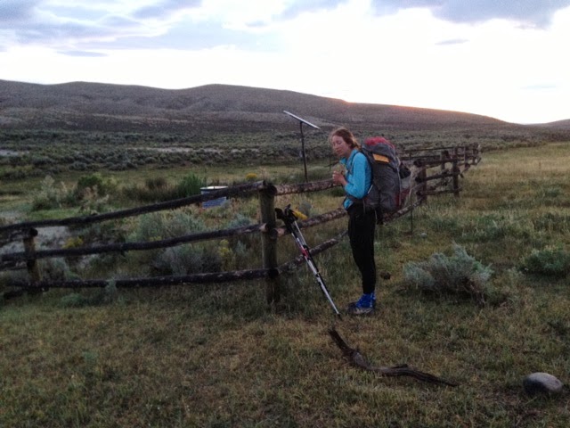
Couldn't sleep last night because some animal was running around our tent last night making that noise. I sleep with earplugs in, but the animal was so loud that I could hear it. I immediately thought we were in mortal peril, and was petrified with fear. I could hear the large sounding animal walking around the surrounding creek, meadow and our tent. Through process of elimination, I knew it wasn't a bird (since it was walking around), and it was large (since it was breaking branches). I was mostly sure it wasn't a bear, since it was not interested in the food we hung far from our tents. But my overactive imagination had me carried away--I was sure it was a badger or wolverine. I calmed myself down and made myself go to sleep. We slept fitfully throughout the rest of the night, hearing these strange noises. Plus, at some point, Gangles woke me again with a deathgrip on my shoulder.

Thankfully, we survived the night, and it was as though nothing happened. There was too much pine duff to see footprints. That said, we had to get out of there. Today, we were going to try to push the ~21mi to Elkhart trailhead and hitch to Pinedale.

A few miles out of camp, as we were climbing Vista Pass, we came across an amazing sight: a group of older women packing up their tents at ~10,000'. It turned out to be a Sierra Club women's group outing. The trip leader is a feisty 69 year old woman named Jill. And we met Debbie and Margie from Tampa Bay, FL. I'm so impressed that they went from sea level to ~10,000' and were so perky and healthy. I was incredibly inspired by all of them--it gives me hope that when I'm their age, I'll be as dynamic and exciting, and backpacking in the winds. And not playing shuffleboard. Not that there's anything wrong with shuffleboard. Meeting those women was my highlight of the day. Superheroines in every day hiker clothing.

And they were so nice to us. They gave us the scoop on Vista and Cube Rock Pass (a rock scramble, just follow the cairns). Plus, they insisted we take some extra food--some delicious protein bars. They wished us luck, and it completely made my day.

The climb up Vista Pass was straightforward, switchbacks up to a great view. Cube Rock Pass was as described, with the trail fading out into a boulder field. As a point of pride, I didn't want to use my hands, so I was walking boulder to boulder, testing each one that it was stable. Giant rock fields always make me a little nervous, since all the rocks are there because they've tumbled down the mountain. Thankfully, they were mostly stable, and we climbed up to Peak Lake, which was a gorgeous blue glacial lake.

From there, we made the ascent to Shannon Pass, which marked our first time above 11,000'. We'll climb higher in CO, but this was our highest point on this thruhike to date. Unfortunately, I could definitely feel it. Slight headache, sluggishness, increased thirst. Definitely feeling the altitude. I was surprised, since we had been camping at ~9,500' for the past few nights, but the jump up to 11,200' was a bit too much for one day. Both Gangles and I were definitely feeling a little altitude sickness, so we tried to race out of there. Unfortunately, the Winds stay relatively high, and we were both a little woozy.

A few miles later at at Upper Jean Lake, we ran into Mike, from Kalamazoo, MI. He was taking a zero day up on the lake since his heel had a huge blister. We chatted for a bit, and gave him some bandaids. He wished us luck, and said he would pray for us. We've met so many kind people who have told us that they're praying for us. Really appreciate the kindness of the wonderful people we're meeting along the way.

We continued down the way, and met ~30 people in total. I was surprised by how populated the Winds are, given the remoteness of the section. But, believe the hype! The Winds are every bit as beautiful as described. Breathtaking. Cash mentioned that there is an amazing lake every 30m on the trail, and he was spot on. Superlative spots everywhere.

Oh, and I should mention, for every person we chatted with, I was doing my best impression of the strange animal we heard outside our tent. HRRRRRH! Consensus among the people we met, it was a moose! It all makes sense. I wish I had just looked outside the tent, and not been such a chicken about it.

On our last mile or so down to the trailhead, we ran into a fun group of 5 Nobos: Cactus, Nicotine, Trip, Virgo and The Tourist. They had been in Pinedale, staying with some ranchers they met in the Southern Winds. They seemed like a really fun group. And they're 1,650mi (+/- 200mi) into their journey. Cut from the same cloth as Cash. I wished we were heading in the same direction. They assured us that the trailhead was packed and that we wouldn't have any trouble getting a hitch.

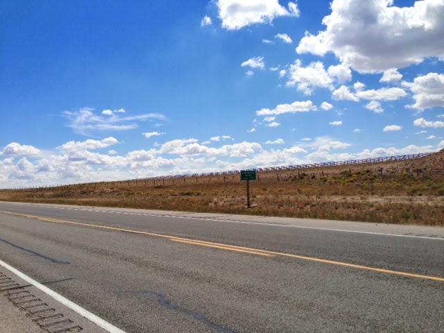
We got down to the road at 7:45pm, and it was like a zombies had ravaged the place. Completely quiet. Tumbleweeds quiet. A parking lot full of cars and devoid of people. For the first time today, I was feeling pessimistic that we would make it into Pinedale. We had been meeting people who were skeptical that we would get in. That was understandable, since most people hike 5-10mi per day, and we were going 20+mi. So, many people openly doubted that we would make it. 12mi out, someone even said, "Pinedale's two days from here! You're not making it in". Not the most encouraging.

In that parking lot, I started to think they were right. We pulled out the map, and saw that any traffic on this road would take us down to Pinedale. Unfortunately, anyone headed back to Pinedale would have probably left already. So, hoping against hope, we decided to walk to the scenic overlook (~1mi) away, in case there was a car there. And if it was teens necking in a car, I had already resolved to slink quietly back to the trailhead and pitch the tent.

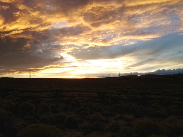
The scenic point was beautiful, but no cars. We saw one car go up to the trailhead, in the wrong direction. We sadly waved, and sat down on a large boulder to watch the sun set behind the ridge. We had made peace with the fact that we would sleep at the trailhead tonight and try in the morning.

Then, we heard a remarkable noise. It was the same car we had seen a few minutes ago, headed now to Pinedale. We waved excitedly, and they pulled over. Laurie, from Houston, was a perky blonde woman wearing an orange UT Austin shirt. She was travelling with an older woman with grey braids. They had been llama packing in the Winds, but one of their llamas took ill. They gave him an enema and everything, but he still wasn't right. So they were headed out early to Pinedale. They kindly gave us a ride to the Brewery, and we settled in for a late dinner.

A long, exhausting and wonderful day on the trail. Thanks to all of the great people we met today, the Sierra Club women's group, Mike, the hikers who diagnosed the moose sounds, and the women who gave us a ride to Pinedale. I wish you all well.

Mileage: ~21mi from Trail Creek to Elkhart Trailhead (Pinedale)