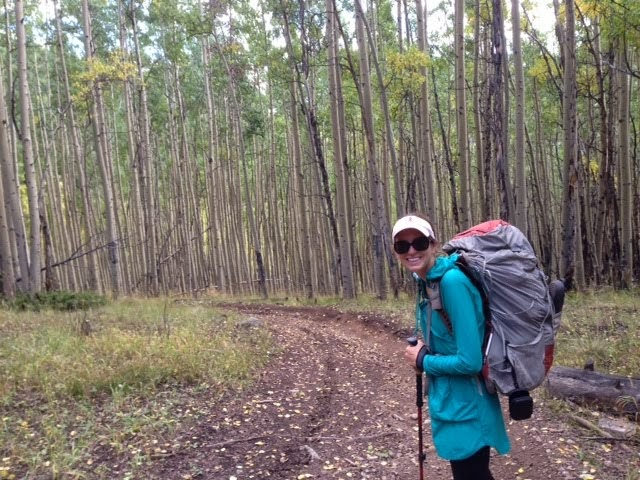
Soaked. Everything was wet from the thunderous rain last night. It seemed so close. Using the scientific Mississippis counting system, I think the lightning was 0.5-3mi away from us last night. I'm so glad we ran down from Chalk Creek Pass, to get low and out of the rain.
Gangles was shivering most of last night, so we made an executive decision: we need to go to town to dry out. The weather might be nice, but we need a mental break before we begin the next 100mi stretch in the the rugged San Juans.
We decided to hike down to Monarch Pass, pick up our maildrop (Thanks, Mom!) and hitch to town. We hung around camp for a while, trying to dry out our things a bit. Gloves, socks, shoes, tent, poncho strewn about camp, to catch the first bit of sustained sunshine we've seen.
Still soaked, but less sopping, we climbed up to Ross Lake Reservoir. We saw some nasty looking clouds coming in. They were probably benign, but we're a little shell-shocked from seemingly fine-looking clouds. So, we bailed off the Divide, down to the road. We were close to Monarch Pass when we were stopped by a young man named Joaquin. He was wearing a hard hat, a yellow vest, and waving a STOP / SLOW sign on a long stick. He stepped right in front of us, and told us we couldn't pass. We were two miles from Monarch Pass, and he said no foot traffic was allowed through. Specifically, no hikers. He told us our options were to hike back the other way, or we had to take a ride up to the pass.
We didn't want to go back up to the Divide, since we were trying to avoid the weather. We had to take a ride. We had to break our continuous footpath, but no option. Joaquin had already spotted us, so no sneaking around. Plus, the road was closed to pedestrian traffic for the next month, i.e., no chance to come back and walk this section tomorrow either. We sat on the side of the road, waiting for the manager to come get us in her pick-up truck. Given how terrible the weather can be, I understood that there was a small window for road construction. Completely respectful of the road closure.
As we were chatting with Joaquin, turns out that we were not stopped for construction. Actually, the closure is due to long-term filming of The Fast & the Furious 7. Car chases, buses exploding with the spectacular mountains in the backdrop. It will make fantastic film. But terribly disappointing for the hike. I decided to be calm, and accept this as just another day on the trail. Just like being forced to skip some sections of the trail due to road closure, this movie is an immovable force.
About an hour later, we got a ride for the last two miles up to the Pass, and picked up our maildrop. Wanting to be good trail citizens, we bought a few things at the store to give them business. Then we hitched down to Salida with a nice guy named Greg. He's headed back home to Colorado Springs, and was very interested in the trail. Somewhat comically, Greg kept asking if we wanted to get dropped off at the McDonald's. Must be the place to go in Salida. Or we looked in desperate need of an Extra Value Meal.
He left us at the Super 8. He did mention we had inspired him to hike the trail, which is wonderful.
Though the 'VACANCY' sign was flashing, the Super 8 had no vacancies. We went next door, and they also had no rooms despite the 'VACANCY' sign. I called around to a few places, and they were all booked. One of the hotel owners gave me the scoop--it could be leaves turning bringing in the tourists. But she thought it was probably because of...The Fast & the Furious 7. Apparently, they had called last month, looking for 280 motel rooms. That darn movie keeps popping up in unexpected and inconvenient places. I suppose a movie about cars chasing other cars, probably has no room for a pair of slow-moving hikers.
So, here we are, unexpectedly in Salida for the night. Brought here, and almost chased away by a movie about cars.
Going to get hot meal, do laundry, and shower. San Juans, see you in the morning!
Mileage: 10mi from near Ross Lake Reservoir to Monarch Pass (-2mi from The Fast & the Furious 7. Sigh.)
Thursday, September 19, 2013
Day 94 - Are you ok?
I don't know if it is a good sign or a bad sign that everyone in a vehicle passing us on the trail today has asked "Are you ok?"
Let's be real, the answer is "No.". We are not ok. We are cold, wet, and walking through thunderstorms on the Divide. But we're going to get to Mexico, come hell or high water. And at this rate, we may see both.
Colorado continues to pitch a perfect game--rain every day since we've been in the state. More than rain, it has usually been thunder and lightning.
I set the alarm clock for 5am, and woke to pouring rain. I hit snooze, and decided to wait it out. Every 30m, I checked, and it was still pouring. Finally at 7am, we decided to make a break for it as the rain let up for a moment.
We went to say goodbye to Brenda and Gerry. They have been so nice and so hospitable. Throughout the day, I half expected Brenda to pull alongside us on a dirt bike offering us pot roast.
The rain went in and out all day. We kept our ponchos on as we climbed 5 passes: Tin Cup, Cumberland, Cumberland II, Cumberland III and Chalk Creek.
On the way up to Cumberland, near the trailhead to St. Elmo, we met a really nice pair of people: Sandy Schultz and Giv Mattingly. They're longtime neighbors who live in St. Elmo. They offered us a hot shower, but since we had sun, we thought we better press on. Sandy and Giv mentioned a USFS crew near the top of the pass. One of the guys on the crew had a girlfirend who was hiking Nobo. Of course, Gangles and I spent the entire climb speculating on who that might be.
When we neared the top of the pass, we met Lorenzo. Turns out his girlfriend Ann is hiking Nobo. And Ann's trail name is Burrito. We met Burrito and Free Radical just North of Brooks Lake Lodge. Of course we remembered her! She was just about the cleanest, freshest hiker I've ever seen. I know this isn't true, but I still remember her in pearls, a twinset, and a perfect blonde bob. Nice to chat with Lorenzo and the USFS crew. Burrito is maybe a week away from the border, so good luck to her, and congrats!
Just after we crossed Cumberland III, we descended to the East side of the Alpine Tunnel. Back in the day, the Alpine Tunnel went under the mountain to move mining supplies. The tunnel eventually started to fill with ground water, so it was closed off at both ends. The trail descends to the East side, then follows a decommissioned railroad bed to Hancock. This 2mi on the railroad bed is about the smoothest part of the entire section, with no more than a 3 degree grade. It was like walking in a museum, with informational signs about local history. Oddly enough, we did see a pair of perfectly ripe peaches, but passed them up. Seemed sketchy to eat random found fruit.
I also saw two marmot-shaped rocks in the middle of the trail: one brown and one snow white. As I approached, I realized the brown rock had little hands, and was not a marmot-shaped rock, it was a marmot. The white rock was indeed a rock, just one resembling a marmot. I imagined that the brown one was a marmot Pygmalion, who had been carving his marble Galatea. Pygmalion dove into his nook as I approached. I realized, I am completely losing my grip on reality, superimposing Greek myths on marmots and rocks. The rain is taking a toll.
On the way up our last pass of the day, it began to rain in earnest. And hidden in the trees, I saw a glimmer of something unusual, man made. It was a grey plastic lock box with a hand written note on top. Trail magic! Soda and treat cache from Liv, a CDT '11! Thanks Liv! Clutch cache.
We had to leave the shelter of the trees to get over Chalk Creek Pass. The rain and hail were relatively light, but as we approached the past, the wind began gusting over us. We were pelted by rain and hail, alternately soaking and stinging us. When we got to the top, we ran down, sliding on the wet grass. Wet grass must be the inspiration for the Slip N' Slide.
We were soaked to the bone, and Gangles' teeth were chattering. We had harbored hope of making it to Hwy 50, but it was too late in the day. As the sun set, we pitched in the first flat spot we found. Shortly afterwards, the rain really set in. I can hear it pounding against the tent now.
We weren't planning on taking a day in Salida, but I think we must--we'll need to dry out and regain our sanity.
Mileage: 20mi from Mirror Lake to somewhere near Ross Lake Reservoir
Let's be real, the answer is "No.". We are not ok. We are cold, wet, and walking through thunderstorms on the Divide. But we're going to get to Mexico, come hell or high water. And at this rate, we may see both.
Colorado continues to pitch a perfect game--rain every day since we've been in the state. More than rain, it has usually been thunder and lightning.
I set the alarm clock for 5am, and woke to pouring rain. I hit snooze, and decided to wait it out. Every 30m, I checked, and it was still pouring. Finally at 7am, we decided to make a break for it as the rain let up for a moment.
We went to say goodbye to Brenda and Gerry. They have been so nice and so hospitable. Throughout the day, I half expected Brenda to pull alongside us on a dirt bike offering us pot roast.
The rain went in and out all day. We kept our ponchos on as we climbed 5 passes: Tin Cup, Cumberland, Cumberland II, Cumberland III and Chalk Creek.
On the way up to Cumberland, near the trailhead to St. Elmo, we met a really nice pair of people: Sandy Schultz and Giv Mattingly. They're longtime neighbors who live in St. Elmo. They offered us a hot shower, but since we had sun, we thought we better press on. Sandy and Giv mentioned a USFS crew near the top of the pass. One of the guys on the crew had a girlfirend who was hiking Nobo. Of course, Gangles and I spent the entire climb speculating on who that might be.
When we neared the top of the pass, we met Lorenzo. Turns out his girlfriend Ann is hiking Nobo. And Ann's trail name is Burrito. We met Burrito and Free Radical just North of Brooks Lake Lodge. Of course we remembered her! She was just about the cleanest, freshest hiker I've ever seen. I know this isn't true, but I still remember her in pearls, a twinset, and a perfect blonde bob. Nice to chat with Lorenzo and the USFS crew. Burrito is maybe a week away from the border, so good luck to her, and congrats!
Just after we crossed Cumberland III, we descended to the East side of the Alpine Tunnel. Back in the day, the Alpine Tunnel went under the mountain to move mining supplies. The tunnel eventually started to fill with ground water, so it was closed off at both ends. The trail descends to the East side, then follows a decommissioned railroad bed to Hancock. This 2mi on the railroad bed is about the smoothest part of the entire section, with no more than a 3 degree grade. It was like walking in a museum, with informational signs about local history. Oddly enough, we did see a pair of perfectly ripe peaches, but passed them up. Seemed sketchy to eat random found fruit.
I also saw two marmot-shaped rocks in the middle of the trail: one brown and one snow white. As I approached, I realized the brown rock had little hands, and was not a marmot-shaped rock, it was a marmot. The white rock was indeed a rock, just one resembling a marmot. I imagined that the brown one was a marmot Pygmalion, who had been carving his marble Galatea. Pygmalion dove into his nook as I approached. I realized, I am completely losing my grip on reality, superimposing Greek myths on marmots and rocks. The rain is taking a toll.
On the way up our last pass of the day, it began to rain in earnest. And hidden in the trees, I saw a glimmer of something unusual, man made. It was a grey plastic lock box with a hand written note on top. Trail magic! Soda and treat cache from Liv, a CDT '11! Thanks Liv! Clutch cache.
We had to leave the shelter of the trees to get over Chalk Creek Pass. The rain and hail were relatively light, but as we approached the past, the wind began gusting over us. We were pelted by rain and hail, alternately soaking and stinging us. When we got to the top, we ran down, sliding on the wet grass. Wet grass must be the inspiration for the Slip N' Slide.
We were soaked to the bone, and Gangles' teeth were chattering. We had harbored hope of making it to Hwy 50, but it was too late in the day. As the sun set, we pitched in the first flat spot we found. Shortly afterwards, the rain really set in. I can hear it pounding against the tent now.
We weren't planning on taking a day in Salida, but I think we must--we'll need to dry out and regain our sanity.
Mileage: 20mi from Mirror Lake to somewhere near Ross Lake Reservoir
Day 93 - Mirror Lakes
We woke up a few hundred feet below Lake Ann Pass, with a lovely view of star-shaped Taylor Reservoir. Since we were just around 12,000 feet, it was a brisk morning. The hiking was beautiful and meandering through the majestic Collegiates.
We did make it down to Mirror Lake just as the sun was setting. I saw a large moose bull with a full rack of antlers, but he startled and ran off into the brush. The campground was relatively primitive, nothing but flat spots to tent. As we were pitching, I did notice a large white RV not more than 100' away. Apparently, Gangles saw this from the pass, but I do have terrible vision.
I went over to say 'hello'. If we end up tenting near someone, I think it is good policy to introduce ourselves. We met a lovely couple from Denver. Gerry and Brenda have been coming out to Mirror Lakes for 28 years. They started with their boys, who are now grown and mostly moved out of CO. We sat by their fire, and chatted with them about their life in Denver, their time at Mirror Lake, and the surrounding peaks. They've climbed them all. When the boys climbed Emma Bird, they would lay their orange and yellow jackets in a snowfield near the peak, so Brenda could see from the bottom that they were ok. Brenda and Gerry were interested in our hike. They had just seen a PBS special on the CDT, so were well-versed in trail culture. They knew we were hungry (or we must of looked pretty scrawny), and were kind enough to grill bacon cheeseburgers for us. Brenda kept trying to feed us, but we have plenty of food. She made us a bag of wonderful treats, with cookies, chips, cheese, candy, and some literature for later. They were truly wonderful people, and it was a blessing to meet them.
The sky looks clear for now, so this might be our first dry day on trail.
Mileage: 21mi from Lake Ann Pass to Mirror Lakes
We did make it down to Mirror Lake just as the sun was setting. I saw a large moose bull with a full rack of antlers, but he startled and ran off into the brush. The campground was relatively primitive, nothing but flat spots to tent. As we were pitching, I did notice a large white RV not more than 100' away. Apparently, Gangles saw this from the pass, but I do have terrible vision.
I went over to say 'hello'. If we end up tenting near someone, I think it is good policy to introduce ourselves. We met a lovely couple from Denver. Gerry and Brenda have been coming out to Mirror Lakes for 28 years. They started with their boys, who are now grown and mostly moved out of CO. We sat by their fire, and chatted with them about their life in Denver, their time at Mirror Lake, and the surrounding peaks. They've climbed them all. When the boys climbed Emma Bird, they would lay their orange and yellow jackets in a snowfield near the peak, so Brenda could see from the bottom that they were ok. Brenda and Gerry were interested in our hike. They had just seen a PBS special on the CDT, so were well-versed in trail culture. They knew we were hungry (or we must of looked pretty scrawny), and were kind enough to grill bacon cheeseburgers for us. Brenda kept trying to feed us, but we have plenty of food. She made us a bag of wonderful treats, with cookies, chips, cheese, candy, and some literature for later. They were truly wonderful people, and it was a blessing to meet them.
The sky looks clear for now, so this might be our first dry day on trail.
Mileage: 21mi from Lake Ann Pass to Mirror Lakes
Day 92 - Matriculating
Today, we left Twin Lakes, sadly. The weather is supposed to be questionable through tomorrow morning, with possible thunderstorms this afternoon and tonight. Even so, this morning seemed different from other mornings in CO, a little drier, a little sunnier. I was feeling optimistic.
We headed straight South from the General Store, on an old dirt road which was slowly melting back into the marsh. This is the most direct route back to the trail, and the most common, though not the official CDT. This is because it winds through a long marsh and several river crossings. At the worst point, we were thigh deep in ice cold water, battling a strong current. The coldness took my breath away, and I was relieved when we made it across. We rejoined the CDT / CT shortly and began the first of the many epic climbs on this stretch: up 3,000' to Hope Pass.
I am relieved to have trail back underfoot, though I know urban girl Gangles misses the relatively level and direct roadwalks. Some Northbounders have described this section as a highlight of the trail, and it is living up to the hype.
This section is lovely but challenging. At the end of the day, we were indeed hit by rain and hail. Soaked, but undeterred, we decided to make the push past Lake Ann, and up to the pass. This means another 2,000' climb, for a total of at least 5,500' today.
We crested the pass just as the sun was setting, so ran down. I found a sloped but passable site for the night. We're sliding towards the foot of the tent, but at least it stopped raining. Fingers crossed for a drier day tomorrow.
Mileage: 19mi from Twin Lakes to just past Lake Ann Pass
We headed straight South from the General Store, on an old dirt road which was slowly melting back into the marsh. This is the most direct route back to the trail, and the most common, though not the official CDT. This is because it winds through a long marsh and several river crossings. At the worst point, we were thigh deep in ice cold water, battling a strong current. The coldness took my breath away, and I was relieved when we made it across. We rejoined the CDT / CT shortly and began the first of the many epic climbs on this stretch: up 3,000' to Hope Pass.
I am relieved to have trail back underfoot, though I know urban girl Gangles misses the relatively level and direct roadwalks. Some Northbounders have described this section as a highlight of the trail, and it is living up to the hype.
This section is lovely but challenging. At the end of the day, we were indeed hit by rain and hail. Soaked, but undeterred, we decided to make the push past Lake Ann, and up to the pass. This means another 2,000' climb, for a total of at least 5,500' today.
We crested the pass just as the sun was setting, so ran down. I found a sloped but passable site for the night. We're sliding towards the foot of the tent, but at least it stopped raining. Fingers crossed for a drier day tomorrow.
Mileage: 19mi from Twin Lakes to just past Lake Ann Pass
Monday, September 16, 2013
Day 91 - Staying low to Twin Lakes
This morning, we woke up at the North end of Leadville. We had fled here, chased down by the thunderstorms on the divide, and had to figure our way back on trail in Twin Lakes.
Gangles' hip was really hurting, probably an injury from our long road walk yesterday. We had a leisurely morning, and she iced her hip, which helped tremendously. I did feebly try to get her to zero, since it was the sabbath, and football was on. She was unswayable. So, we hiked out.
Leadville is an adorable town, with a bustling downtown. We picked up a cup of coffee for the walk, and it was the best cup of coffee on the entire trail so far.
The rest of the walk was uneventful, and dull, following the road to Twin Lakes. We were hit with two hours of steady cold rain, coming down from the Divide. We had agonized about where we would get back on the trail, but due to weather, decided to take the low route. This was the wise course of action, since the Divide was socked in dark clouds all afternoon. When we heard the thunder, we were sure we had picked the right route.
The rain let up about an hour North of Twin Lakes, and we were just starting to dry out. We thankfully got a room and are in for the night. We'll check the weather, and make a final call on if we'll take the Collegiate West route (official CDT, mostly above tree line, spectacular) or the Collegiate East route (official CT, mostly below tree line, safer) in the morning.
Thoughts and prayers to everyone in CO who has been affected by the rain. Stay safe.
p.s., Definitely in the bubble. In the register, big gap between the last Nobos, and the first Sobos. Just a few ahead of us. Hope to see more Sobos soon
Mileage: 18mi from Leadville to Twin Lakes
Gangles' hip was really hurting, probably an injury from our long road walk yesterday. We had a leisurely morning, and she iced her hip, which helped tremendously. I did feebly try to get her to zero, since it was the sabbath, and football was on. She was unswayable. So, we hiked out.
Leadville is an adorable town, with a bustling downtown. We picked up a cup of coffee for the walk, and it was the best cup of coffee on the entire trail so far.
The rest of the walk was uneventful, and dull, following the road to Twin Lakes. We were hit with two hours of steady cold rain, coming down from the Divide. We had agonized about where we would get back on the trail, but due to weather, decided to take the low route. This was the wise course of action, since the Divide was socked in dark clouds all afternoon. When we heard the thunder, we were sure we had picked the right route.
The rain let up about an hour North of Twin Lakes, and we were just starting to dry out. We thankfully got a room and are in for the night. We'll check the weather, and make a final call on if we'll take the Collegiate West route (official CDT, mostly above tree line, spectacular) or the Collegiate East route (official CT, mostly below tree line, safer) in the morning.
Thoughts and prayers to everyone in CO who has been affected by the rain. Stay safe.
p.s., Definitely in the bubble. In the register, big gap between the last Nobos, and the first Sobos. Just a few ahead of us. Hope to see more Sobos soon
Mileage: 18mi from Leadville to Twin Lakes
Sunday, September 15, 2013
Day 90 - I've got friends in low places
Before I went to bed last night, I definitely had the spins. Since I saw neither empty kegs nor whiskey bottles, I was definitely affected by the altitude, We were above 9,000', but Boulder is only around 5,000'. The four days I spent in Boulder was enough to spike my acclimatization. I took two advil and drank a lot of water, fingers crossed for the morning.
I felt much better this morning. Less groggy and punch drunk. Since the clouds and rain tend to come around noon, we got an early start to take advantage of the clear weather. We walked through Frisco on the Colorado Trail to Copper Mountain. The views were lovely from the valley, looking up at the mountains.
The weather was mostly clear, though the clouds did drift in gradually. By the time we made the 9mi to Copper Mountain, the clouds were coming in fast. The divide was clamped down in black clouds, which were thickening and spreading. Our choices were to climb back up into the clouds on the Divide, or road walk to Leadville. Given the torrential rain statewide in the past week, we decided to take the low route to Leadville.
Road walking is a necessary evil on the CDT. Since the trail is not fully complete, there are long stretches where the 'official' trail runs along roads, sometimes unpaved seldom used dirt roads, sometimes major highways. Road walking is fast, but painful. Repetitive walking on hard surfaces with a full pack usually results in overuse injuries and other aches and pains. So, definitely not relishing the idea of a 24mi road walk starting at 11am, but didn't want to play chicken with the lightning up on the Divide.
Shortly after we set off towards Leadville, I turned around to look behind us. The storm was hot on our heels, and Copper Mountain was already obscured in rain. We kept going, and repeated our Colorado mantra: It will rain on us today, and we will be fine.
Colorado has still maintained a perfect record of daily rain since we entered the state in late August. At times, drizzle, other times torrential thunderstorms. We can only surrender ourselves to the weather and be prepared. Zen-like peace with being soaked.
The rain did catch us, and we threw on our ponchos. The drizzle turned into steady hail, and we trudged along the highway, past Kokomo and Climax, abandoned and active mining sites. The skies eventually cleared, and I checked my phone. The other Sobohobos, close behind us, had been on the ridge, and had a close call with lightning. They were bailing down to the road, too. Staying low is the smart move.
We finally arrived in Leadville around 7pm, and checked in to a hotel. No need to wait around for the next rain storm. We'll head to Twin Lakes in the morning. The weather should start to clear up in 2 days. We'll play it safe until then.
Mileage: 33mi from Frisco to Leadville
I felt much better this morning. Less groggy and punch drunk. Since the clouds and rain tend to come around noon, we got an early start to take advantage of the clear weather. We walked through Frisco on the Colorado Trail to Copper Mountain. The views were lovely from the valley, looking up at the mountains.
The weather was mostly clear, though the clouds did drift in gradually. By the time we made the 9mi to Copper Mountain, the clouds were coming in fast. The divide was clamped down in black clouds, which were thickening and spreading. Our choices were to climb back up into the clouds on the Divide, or road walk to Leadville. Given the torrential rain statewide in the past week, we decided to take the low route to Leadville.
Road walking is a necessary evil on the CDT. Since the trail is not fully complete, there are long stretches where the 'official' trail runs along roads, sometimes unpaved seldom used dirt roads, sometimes major highways. Road walking is fast, but painful. Repetitive walking on hard surfaces with a full pack usually results in overuse injuries and other aches and pains. So, definitely not relishing the idea of a 24mi road walk starting at 11am, but didn't want to play chicken with the lightning up on the Divide.
Shortly after we set off towards Leadville, I turned around to look behind us. The storm was hot on our heels, and Copper Mountain was already obscured in rain. We kept going, and repeated our Colorado mantra: It will rain on us today, and we will be fine.
Colorado has still maintained a perfect record of daily rain since we entered the state in late August. At times, drizzle, other times torrential thunderstorms. We can only surrender ourselves to the weather and be prepared. Zen-like peace with being soaked.
The rain did catch us, and we threw on our ponchos. The drizzle turned into steady hail, and we trudged along the highway, past Kokomo and Climax, abandoned and active mining sites. The skies eventually cleared, and I checked my phone. The other Sobohobos, close behind us, had been on the ridge, and had a close call with lightning. They were bailing down to the road, too. Staying low is the smart move.
We finally arrived in Leadville around 7pm, and checked in to a hotel. No need to wait around for the next rain storm. We'll head to Twin Lakes in the morning. The weather should start to clear up in 2 days. We'll play it safe until then.
Mileage: 33mi from Frisco to Leadville
Friday, September 13, 2013
Special thanks to Patrick
For braving the flood to get us back on trail today. 3+ hours of driving is epic. We appreciate it.
Hope you and your roommates stay dry tonight and throughout the rain in the coming week.
Gangles does her Buffs dance of joy for you!
Hope you and your roommates stay dry tonight and throughout the rain in the coming week.
Gangles does her Buffs dance of joy for you!
Subscribe to:
Posts (Atom)