This morning, I crossed 8mi of lava on the Zuni-Acoma trail, which has been around for nearly 1,000 years. It is a trail across rough, spongy-looking lava rocks ranging in size from pebbles to huge boulders. The spongy rocks look light and airy, but are actually hard as, well, rocks. And the roughness is tough terrain, like walking across a 3D buzzsaw. The most wear I've put on my shoes this trip was the short stretch on the lava, tearing out small chunks of rubber as I walked. The terrain varied, with some slabs of long, relatively flat stretches, and some stretches of loose scree with poor footing. The informational signs at both ends note that the Spaniards could not cross the lava with pack animals, even on the trail, and detoured around the area.
And yet, this is one of my favorite sections of the CDT so far. Thanks to the Mumms, I had the eyes to enjoy this section of trail. I had a real thrill walking along the winding trail, knowing that people have been crossing it for hundreds of years on this very route. The way is marked only with cairns, and I had to look cairn to cairn like a treasure hunt to navigate. We came across some signs on civilization--a semi-circle of rocks marking the foundation of an old structure, bridges of lava rock pressed tightly together to cross deep crevices. Truly a unique section of trail.
Plus, before we started the lava rocks, we came across a surprise, courtesy of Skarkle Cat. They left us some trail magic at the trailhead. Any challenge, when fueled by Sprite and donuts, seems more fun. Thanks, Skarkle Cat.
After the lava rocks, we stopped at the Mumm's next water cache at Hwy 117. We gratefully drank the fresh, clean water, which is in such short supply in the area. Thank you, Hugo and Carole!
A few miles later, we arrived at La Ventana, a natural sandstone arch. I'm terrible with proportions, but the arch must be at least 100' across. We hit it at the right time, and it was incandescent with the noon sun.
And here's where the wheels came off. The Ley maps note an alternate trail, on the rim above La Ventana. Though we had 30mi on the docket, we didn't want to miss the hike on the rim of the mesa. So, we followed the dashed line on the map, and bushwhacked up to the top of the mesa.
I wanted to take the all forested approach, in the center of the bowl. Gangles suggested we hug the edge of the bowl tightly, and go up right next to La Ventana, which seemed to be indicated by the map. As we climbed next to La Ventana, we crossed numerous cave dwellings carved out of the sandstone. One had a partition wall intact. Fascinating. We kept climbing, a few hundred feet, the tread becoming steeper and more rocky. From the valley, the top of the bowl looked sheer, but with enough angle that we could switchback up. By the time we arrived at the rim, we realized that we couldn't get up the last 15'. The bowl had evolved slowly into sheer, 90 degree sandstone. There were some footholds and handholds, but we were not confident enough climbers / boulderers to get all the way up. [Note: Passable if you have climbing skills; also, the better bushwhack is the forested, non-cliff route] We managed to climb with full packs partway, but couldn't climb the last 5'.
We were stuck, at the top of the bowl, with 5' of impassable cliff at top. We had to descend. It was so steep that we were sliding feet first, crab-wise, down the rocks. We couldn't descend standing up. At some point, the rock was so steep, I felt if I slid, I might go right off the edge. I braced myself and just pointed at a tree, which luckily broke my fall. On another slide, I was sliding, wedged in a crevice, but the weight of my pack was pulling me down the rock headfirst. Gangles guided me down by grabbing my leg, so thanks for the assist. I was pleasantly surprised we survived without head injuries. Harrowing.
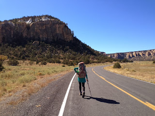
Three hours later, we were back in the same place where we started. We shook off the adrenaline and hiked as fast as we could down Hwy 117. We had to clear it by sundown, since there have been reports of drug activity on the road (small planes dropping packages, idling trucks waiting nearby, warning shots fired at CDT hiker tents).
And sitting on the side of the road...MASA! He was recovering from his cold and had set out from Grants earlier that day. We chatted for a minute, and then pushed on.
We did clear Hwy 117, and had to night hike a bit to get to Pie Town road. Long, exhausting day. While I am sitting in the tent, some truck passed and let out a shrill 'YEEHAW!'. I hope that's a friendly whoop.
Mileage: ~25-30mi from near Hwy 53 to near Pie Town Rd


No comments:
Post a Comment